
IMAGES TAKEN NEAR TO
Green Lane, ILKLEY, LS29 7AZ
Introduction
This page details the photographs taken nearby to Green Lane, LS29 7AZ by members of the Geograph project.
The Geograph project started in 2005 with the aim of publishing, organising and preserving representative images for every square kilometre of Great Britain, Ireland and the Isle of Man.

There are currently over 7.5m images from over14,400 individuals and you can help contribute to the project by visiting https://www.geograph.org.uk
Image Map
Images are licensed for reuse under creativecommons.org/licenses/by-sa/2.0
Notes
- Clicking on the map will re-center to the selected point.
- The higher the marker number, the further away the image location is from the centre of the postcode.
Image Listing (15 Images Found)
Images are licensed for reuse under creativecommons.org/licenses/by-sa/2.0
Image
Details
Distance
1
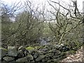
Former Mill dam above Burley Woodhead
Image: © Michael Steele
Taken: 6 May 2013
0.12 miles
2

Track onto Rombalds Moor
The wall to the right encloses grazing land. The track is a public footpath.
Image: © Stephen Craven
Taken: 13 Mar 2016
0.16 miles
3

A small tarn on Rombalds Moor
This pond or tarn does not appear on any new or old map that I looked at. It must be quite shallow. Water enters from the right (west) side and overflows to the far end (south).
Image: © Stephen Craven
Taken: 13 Mar 2016
0.17 miles
4
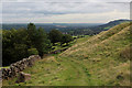
On Stocks Hill
Located below Hawksworth Moor, this spot affords wide ranging views to the north and east towards Almscliffe Crag and Lower Wharfedale.
Image: © Chris Heaton
Taken: 11 Sep 2020
0.18 miles
6

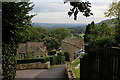
Sheep grazing in Stocks Hill
Pasture on the north-facing slopes of the Wharfe valley overlooking Burley-in Wharfedale is used for sheep farming. Almscliff Crag (SE268489 ) can be seen in the far distance on the right.
Image: © Richard Kay
Taken: 28 Feb 2011
0.19 miles
7
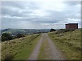
Track on Burley Moor
With Menston in the valley and Otley Chevin beyond.
Image: © Rich Tea
Taken: 13 Aug 2007
0.20 miles
8
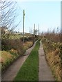
Green Lane
Green Lane is the name of this little road rather than a description of it. The lane serves several houses and farms on the hillside above Burley Woodhead.
Image: © Gordon Hatton
Taken: 8 Jan 2020
0.21 miles
9
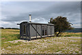
Converted Goods Wagon on Stocks Hill
This strange looking structure on the edge of Hawksworth almost defies description.
It stands alone beside a moorland track, and appears to have been converted into an office facility out of rolling stock.
Image: © Chris Heaton
Taken: 11 Sep 2020
0.21 miles
10
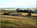
Carr Bottom Farm, near Burley Woodhead
Below Carr Bottom Reservoir
Image: © David Spencer
Taken: 6 Aug 2005
0.23 miles