IMAGES TAKEN NEAR TO
Otley Road, ILKLEY, LS29 6AA
Introduction
This page details the photographs taken nearby to Otley Road, LS29 6AA by members of the Geograph project.
The Geograph project started in 2005 with the aim of publishing, organising and preserving representative images for every square kilometre of Great Britain, Ireland and the Isle of Man.

There are currently over 7.5m images from over14,400 individuals and you can help contribute to the project by visiting https://www.geograph.org.uk
Image Map
Images are licensed for reuse under creativecommons.org/licenses/by-sa/2.0
Notes
- Clicking on the map will re-center to the selected point.
- The higher the marker number, the further away the image location is from the centre of the postcode.
Image Listing (47 Images Found)
Images are licensed for reuse under creativecommons.org/licenses/by-sa/2.0
Image
Details
Distance
1
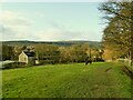
Low Mill, Ellar Ghyll, Menston (rear view)
The factory is named on the 1908 map as Higher Gill Mill (there was a Gill Mill across the road), on the 1956 map as Eller Ghyll Mill, and on current maps as Low Mill. I haven't found any information about what type of textiles were woven here (assuming it was textiles) or when it closed. It seems to be used now (or most recently) as a general engineering works.
Image: © Stephen Craven
Taken: 22 Nov 2020
0.00 miles
2
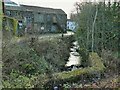
Low Mill, Ellar Ghyll, Menston (detail 2)
The factory is named on the 1908 map as Higher Gill Mill (there was a Gill Mill across the road), on the 1956 map as Eller Ghyll Mill, and on current maps as Low Mill. I haven't found any information about what type of textiles were woven here (assuming it was textiles) or when it closed. It seems to be used now (or most recently) as a general engineering works. The beck in the foreground, which forms the Leeds/Bradford boundary, would have originally provided power for the mill, as there is a mill pond shown on old maps.
Image: © Stephen Craven
Taken: 22 Nov 2020
0.04 miles
3
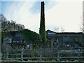
Low Mill, Ellar Ghyll, Menston
The factory is named on the 1908 map as Higher Gill Mill (there was a Gill Mill across the road), on the 1956 map as Eller Ghyll Mill, and on current maps as Low Mill. I haven't found any information about what type of textiles were woven here (assuming it was textiles) or wen it closed. It seems to be used now (or most recently) as a general engineering works.
Image: © Stephen Craven
Taken: 22 Nov 2020
0.04 miles
4
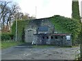
Low Mill, Ellar Ghyll, Menston (detail 1)
The factory is named on the 1908 map as Higher Gill Mill (there was a Gill Mill across the road), on the 1956 map as Eller Ghyll Mill, and on current maps as Low Mill. I haven't found any information about what type of textiles were woven here (assuming it was textiles) or when it closed. It seems to be used now (or most recently) as a general engineering works.
Image: © Stephen Craven
Taken: 22 Nov 2020
0.05 miles
7
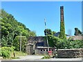
Menston, Imperial Works
According to the OS benchmark database there was a cutmark on a left hand gatepost at the entrance to the works. Nothing was found.
Image: © Mel Towler
Taken: 12 Aug 2022
0.06 miles
8
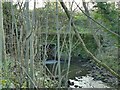
Bridge over Ellar Ghyll
The ghyll (beck) is the border between, on the left, Leeds district (formerly Otley borough), and on the right, Bradford district (formerly Menston borough). The A6038 road therefore changes name here from Otley Road (Bradford) to Bradford Road (Otley). There was probably a stone bridge here originally but it's now a modern concrete culvert.
Image: © Stephen Craven
Taken: 22 Nov 2020
0.06 miles
9
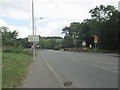
Otley Road - viewed from Ellar Gardens
Image: © Betty Longbottom
Taken: 29 Jul 2013
0.07 miles