
Low Mill, Ellar Ghyll, Menston (detail 2)
Introduction
The photograph on this page of Low Mill, Ellar Ghyll, Menston (detail 2) by Stephen Craven as part of the Geograph project.
The Geograph project started in 2005 with the aim of publishing, organising and preserving representative images for every square kilometre of Great Britain, Ireland and the Isle of Man.

There are currently over 7.5m images from over 14,400 individuals and you can help contribute to the project by visiting https://www.geograph.org.uk
Low Mill, Ellar Ghyll, Menston (detail 2)
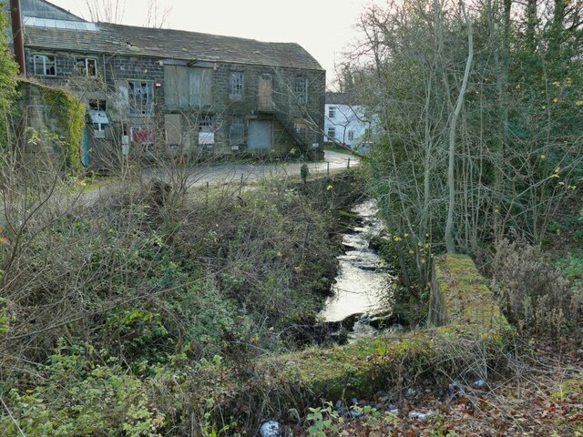
Image: © Stephen Craven Taken: 22 Nov 2020
The factory is named on the 1908 map as Higher Gill Mill (there was a Gill Mill across the road), on the 1956 map as Eller Ghyll Mill, and on current maps as Low Mill. I haven't found any information about what type of textiles were woven here (assuming it was textiles) or when it closed. It seems to be used now (or most recently) as a general engineering works. The beck in the foreground, which forms the Leeds/Bradford boundary, would have originally provided power for the mill, as there is a mill pond shown on old maps.
Images are licensed for reuse under creativecommons.org/licenses/by-sa/2.0
Image Location

Latitude
53.895473
Longitude
-1.730773