IMAGES TAKEN NEAR TO
Linton Avenue, WETHERBY, LS22 6SQ
Introduction
This page details the photographs taken nearby to Linton Avenue, LS22 6SQ by members of the Geograph project.
The Geograph project started in 2005 with the aim of publishing, organising and preserving representative images for every square kilometre of Great Britain, Ireland and the Isle of Man.

There are currently over 7.5m images from over14,400 individuals and you can help contribute to the project by visiting https://www.geograph.org.uk
Image Map (Loading...)


Getting Data...Please wait
Leaflet Map data © OpenStreetMap
Images are licensed for reuse under creativecommons.org/licenses/by-sa/2.0
Notes
- Clicking on the map will re-center to the selected point.
- The higher the marker number, the further away the image location is from the centre of the postcode.
Image Listing (84 Images Found)
Images are licensed for reuse under creativecommons.org/licenses/by-sa/2.0
Image
Details
Distance
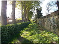
4

Path in a cutting
Looking along the former Harrogate - Wetherby railway line on the west to south section of the triangle.
Image: © DS Pugh
Taken: 18 Apr 2022
0.08 miles
5
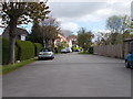
Lazenby Fold and Lazenby Drive
Off Glebe Field Drive.
Image: © Christine Johnstone
Taken: 8 Apr 2012
0.09 miles
7
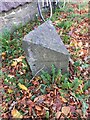
Old Boundary Marker on the A661 in Wetherby
Parish Boundary Marker on the southeast side of the A661 Spofforth Hill immediately southwest of the junction with The Spinney. BS is inscribed on the top face. Both metal plates are missing but this is on the former boundary of Linton and Wetherby townships in Spofforth parish. Both became parishes in 1866 and Linton was absorbed into Collingham and Wetherby parishes in 1937. Now entirely in Wetherby parish.
Milestone Society National ID: YW_WETH02pb
Image: © P Robertson
Taken: 25 Nov 2021
0.09 miles
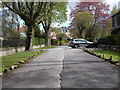
8
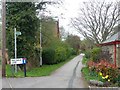
Rail Balk Lane, Wetherby
Now a public footpath crossing a fairly new housing development.
Image: © Christine Johnstone
Taken: 8 Apr 2012
0.09 miles
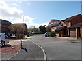
9
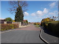
Overdale Close - viewed from Lazenby Drive
Image: © Betty Longbottom
Taken: 3 May 2016
0.10 miles
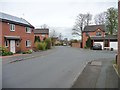
10
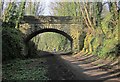
Bridge over disused railway near Wetherby
The bridge, which links Quarry Hill Lane to the Hill Top estate, is also shown in Image and, from above, in Image The Harland Way follows the former railway to Spofforth.
Image: © Derek Harper
Taken: 6 Apr 2015
0.10 miles