IMAGES TAKEN NEAR TO
Hall Park Garth, LEEDS, LS18 5LT
Introduction
This page details the photographs taken nearby to Hall Park Garth, LS18 5LT by members of the Geograph project.
The Geograph project started in 2005 with the aim of publishing, organising and preserving representative images for every square kilometre of Great Britain, Ireland and the Isle of Man.

There are currently over 7.5m images from over14,400 individuals and you can help contribute to the project by visiting https://www.geograph.org.uk
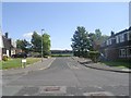
Image Map
Images are licensed for reuse under creativecommons.org/licenses/by-sa/2.0
Notes
- Clicking on the map will re-center to the selected point.
- The higher the marker number, the further away the image location is from the centre of the postcode.
Image Listing (180 Images Found)
Images are licensed for reuse under creativecommons.org/licenses/by-sa/2.0
Image
Details
Distance
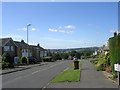
1
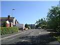
Hall Park Garth - Hall Park Avenue
Image: © Betty Longbottom
Taken: 22 Aug 2011
0.04 miles
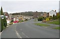
5
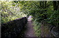
Horsforth: Footpath from Hall Lane to Hunger Hills
There is a right of way along this pleasant walled path.
Image: © Dr Neil Clifton
Taken: 25 May 1992
0.08 miles
7
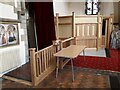
New facilities in St Margaret's church
Since my last visit, this small kitchen has been added in the south-west corner of the church along with a short ramp to improve access through the south porch. Design by the local architect Richard Crooks, who died in 2022 not long after the works were completed.
Image: © Stephen Craven
Taken: 18 Mar 2023
0.08 miles
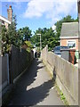
8
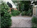
Junction of footpaths north of Hall Lane
The path in the foreground looking ahead is the public footpath connecting Hunger Hills woodland with Hall Lane; at this point it crosses an urban footpath or ginnel connecting West End Drive and Hall Park Avenue.
Image: © Stephen Craven
Taken: 11 Jun 2021
0.08 miles
9
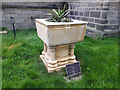
Retired font, St Margaret's church, Horsforth
The church acquired a smaller font from another, closed, church in 2019 as part of a reordering project. The original large Victorian font now serves as a planter outside the building, with a notice reminding people that "generations were christened in it and welcomed through baptism into the family of the church".
Image: © Stephen Craven
Taken: 16 May 2020
0.09 miles
10
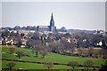
St Margarets Church, Horsforth, Leeds
Image: © Mark Stevenson
Taken: 8 Apr 2015
0.09 miles