IMAGES TAKEN NEAR TO
Hall Park Avenue, LEEDS, LS18 5LR
Introduction
This page details the photographs taken nearby to Hall Park Avenue, LS18 5LR by members of the Geograph project.
The Geograph project started in 2005 with the aim of publishing, organising and preserving representative images for every square kilometre of Great Britain, Ireland and the Isle of Man.

There are currently over 7.5m images from over14,400 individuals and you can help contribute to the project by visiting https://www.geograph.org.uk
Image Map
Images are licensed for reuse under creativecommons.org/licenses/by-sa/2.0
Notes
- Clicking on the map will re-center to the selected point.
- The higher the marker number, the further away the image location is from the centre of the postcode.
Image Listing (224 Images Found)
Images are licensed for reuse under creativecommons.org/licenses/by-sa/2.0
Image
Details
Distance
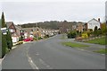
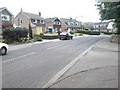
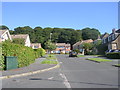
2
Hall Park Garth - Hall Park Avenue
Image: © Betty Longbottom
Taken: 22 Aug 2011
0.04 miles
4
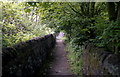
Horsforth: Footpath from Hall Lane to Hunger Hills
There is a right of way along this pleasant walled path.
Image: © Dr Neil Clifton
Taken: 25 May 1992
0.07 miles
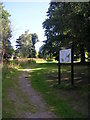
5
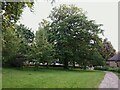
Green space off Hall Lane
This small green space between areas of housing includes the public footpath seen in the photo, but is also counted as part of the Hunger Hills public open space (the majority of which consists of a woodland, separated from this section by several hundred metres, and connected by this path).
Image: © Stephen Craven
Taken: 11 Jun 2021
0.07 miles
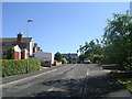
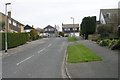
6
Hall Lane, Horsforth
By one of the entrances to Horsforth Hall Park.
Image: © Rich Tea
Taken: 5 May 2007
0.07 miles
8
Footpath off Hall Lane to Hunger Hills, Horsforth
Image: © Rich Tea
Taken: 5 May 2007
0.08 miles
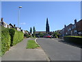
9
West End Drive - viewed from Hunger Hills Drive
Image: © Betty Longbottom
Taken: 22 Aug 2011
0.08 miles
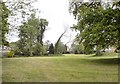
10
Footpath across Hunger Hills Nature Area - Hall Lane
Image: © Betty Longbottom
Taken: 22 Aug 2011
0.08 miles