IMAGES TAKEN NEAR TO
Hall Lane, LEEDS, LS18 5JF
Introduction
This page details the photographs taken nearby to Hall Lane, LS18 5JF by members of the Geograph project.
The Geograph project started in 2005 with the aim of publishing, organising and preserving representative images for every square kilometre of Great Britain, Ireland and the Isle of Man.

There are currently over 7.5m images from over14,400 individuals and you can help contribute to the project by visiting https://www.geograph.org.uk
Image Map
Images are licensed for reuse under creativecommons.org/licenses/by-sa/2.0
Notes
- Clicking on the map will re-center to the selected point.
- The higher the marker number, the further away the image location is from the centre of the postcode.
Image Listing (220 Images Found)
Images are licensed for reuse under creativecommons.org/licenses/by-sa/2.0
Image
Details
Distance
1
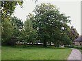
Green space off Hall Lane
This small green space between areas of housing includes the public footpath seen in the photo, but is also counted as part of the Hunger Hills public open space (the majority of which consists of a woodland, separated from this section by several hundred metres, and connected by this path).
Image: © Stephen Craven
Taken: 11 Jun 2021
0.02 miles
2
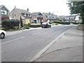
Hall Lane, Horsforth
By one of the entrances to Horsforth Hall Park.
Image: © Rich Tea
Taken: 5 May 2007
0.03 miles
3
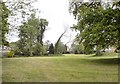
Footpath off Hall Lane to Hunger Hills, Horsforth
Image: © Rich Tea
Taken: 5 May 2007
0.03 miles
4
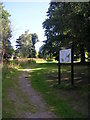
Footpath across Hunger Hills Nature Area - Hall Lane
Image: © Betty Longbottom
Taken: 22 Aug 2011
0.03 miles
6
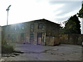
Former stables, Horsforth Hall Park
Horsforth Hall itself was demolished over 60 years ago but some outbuildings including this stable block are still used by Leeds City Council's parks department. It is listed grade II (list entry 1261240) and dates from the late 18th century, despite incorporating a datestone of 1707.
Image: © Stephen Craven
Taken: 21 Aug 2020
0.05 miles
7

Commemorative plaque, Horsforth Hall Park
"This Hall and Park was presented to the Township by William Mathieson Esq of Glenburn, Horsforth & opened by him on 7th May 1932.
A newspaper photograph of Mr & Mrs Mathieson at the opening ceremony can be seen on the Leodis archive here http://www.leodis.net/display.aspx?resourceIdentifier=2002411_73005313&DISPLAY=FULL
This plaque is on a wall on the site of Horsforth Hall which was demolished in the 1950s.
See also Image]
Image: © Rich Tea
Taken: 5 May 2007
0.06 miles
8

Site of Horsforth Hall
Horsforth Hall was built in the early 18th century for the Stanhope family. The Hall and Park were given to the people of Horsforth in 1932. The Hall was demolished in the 1950s, a few of the outbuildings which are used by the council remain behind this wall.
The Hall can be seen in a photo on the Leodis archive http://www.leodis.net/display.aspx?resourceIdentifier=2002411_65069217
See also Image]
Image: © Rich Tea
Taken: 5 May 2007
0.06 miles