IMAGES TAKEN NEAR TO
West End Lane, LEEDS, LS18 5EP
Introduction
This page details the photographs taken nearby to West End Lane, LS18 5EP by members of the Geograph project.
The Geograph project started in 2005 with the aim of publishing, organising and preserving representative images for every square kilometre of Great Britain, Ireland and the Isle of Man.

There are currently over 7.5m images from over14,400 individuals and you can help contribute to the project by visiting https://www.geograph.org.uk
Image Map
Images are licensed for reuse under creativecommons.org/licenses/by-sa/2.0
Notes
- Clicking on the map will re-center to the selected point.
- The higher the marker number, the further away the image location is from the centre of the postcode.
Image Listing (54 Images Found)
Images are licensed for reuse under creativecommons.org/licenses/by-sa/2.0
Image
Details
Distance
1
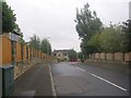
West Pasture Close - West End Lane
Image: © Betty Longbottom
Taken: 10 Sep 2011
0.01 miles
2
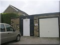
Electricity Substation No 4202 - West End Lane
Image: © Betty Longbottom
Taken: 10 Sep 2011
0.03 miles
3
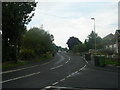
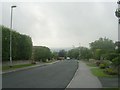
West End Lane - viewed from West End Rise
Image: © Betty Longbottom
Taken: 10 Sep 2011
0.04 miles
4
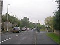
West End Lane - looking down from West End Rise
Image: © Betty Longbottom
Taken: 10 Sep 2011
0.05 miles
5
West End Rise - viewed from West End Lane
Image: © Betty Longbottom
Taken: 10 Sep 2011
0.05 miles
7
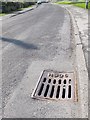
Gully, marked HUDC
Seen on West End Lane. I presume the initials stand for Horsforth Urban District Council, which dates it between 1894 and 1974.
Image: © Stephen Craven
Taken: 8 May 2016
0.07 miles
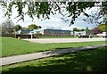
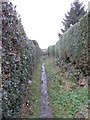
9

West End Primary School
Seen from the footpath that runs past the eastern edge of the site.
Image: © Stephen Craven
Taken: 8 May 2016
0.10 miles
10
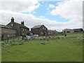
Springfield Farm, West End, Horsforth
The 18th century farmhouse (left) is listed grade 2 (list entry 1240147). The map with the list entry suggests it is the building in the centre of this photo but the description matches the building to the left, of which this is the rear view.
Image: © Stephen Craven
Taken: 14 Aug 2016
0.11 miles