
IMAGES TAKEN NEAR TO
Craggwood Road, LEEDS, LS18 4RW
Introduction
This page details the photographs taken nearby to Craggwood Road, LS18 4RW by members of the Geograph project.
The Geograph project started in 2005 with the aim of publishing, organising and preserving representative images for every square kilometre of Great Britain, Ireland and the Isle of Man.

There are currently over 7.5m images from over14,400 individuals and you can help contribute to the project by visiting https://www.geograph.org.uk
Image Map
Images are licensed for reuse under creativecommons.org/licenses/by-sa/2.0
Notes
- Clicking on the map will re-center to the selected point.
- The higher the marker number, the further away the image location is from the centre of the postcode.
Image Listing (255 Images Found)
Images are licensed for reuse under creativecommons.org/licenses/by-sa/2.0
Image
Details
Distance
1
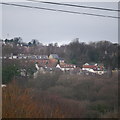
A distant view of the Outwood area of Horsforth
This view is taken from Bramley Fall Park, about 1 km away on the south side of the Aire Valley. The nearest houses are on Outwood Lane, the white houses are on Beech Avenue, with Craggwood Road behind.
Image: © Rich Tea
Taken: 25 Jan 2015
0.01 miles
2
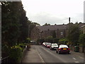
Craggwood Road, Horsforth, Leeds
Looking south, from the corner into Craggwood Close.
Image: © Rich Tea
Taken: Unknown
0.01 miles
3
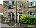
Horsforth, 28 Craggwood Road
There is a benchmark cut into the north-west face of the terraced house.
Image: © Mel Towler
Taken: 3 Sep 2022
0.01 miles
4
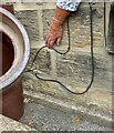
Horsforth, 28 Craggwood Road
The benchmark is cut into the north-west face of the terraced house.
Image: © Mel Towler
Taken: 3 Sep 2022
0.01 miles
5
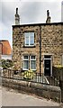
#28 Craggwood Road
There is an Ordnance Survey benchmark Image on the front of the house at its left hand corner
Image: © Roger Templeman
Taken: 24 Jul 2023
0.01 miles
6
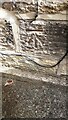
Benchmark on #28 Craggwood Road
Ordnance Survey cut mark benchmark levelled at 96.472m above Newlyn Datum verified 1957
Image: © Roger Templeman
Taken: 24 Jul 2023
0.02 miles
7
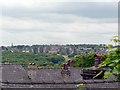
The roofs of Craggwood Road from Wood Lane, Horsforth
Craggwood Road is much lower than Wood Lane, as this view over the roofs shows. In the distance is Bramley, on the far side of the Aire Valley, with the spire of Bramley Parish Church on the horizon at the left (See Image])
Image: © Rich Tea
Taken: 27 May 2006
0.02 miles
8
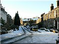
Craggwood Road, Horsforth, Christmas Day 2009
Image: © Rich Tea
Taken: 25 Dec 2009
0.02 miles
9
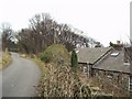
Wood Lane (5), Horsforth, Leeds
The backs of the cottages to the right are well below the level of Wood Lane, and their windows look at a rocky wall. This is probably the crag which comes into the name Cragg Hill and Cragg Wood. However it is not clear if it is natural or man-made - the area was quarried for stone.
Image: © Rich Tea
Taken: 22 Feb 2006
0.02 miles
10
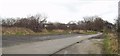
Wood Lane (4), Horsforth, Leeds
This section is signposted as a No Through Road, and leads to a few houses at Cragg Hill. On the left behind the hedge is Cragg Hill recreation ground.
Image: © Rich Tea
Taken: 22 Feb 2006
0.02 miles