
IMAGES TAKEN NEAR TO
Newlaithes Gardens, LEEDS, LS18 4JU
Introduction
This page details the photographs taken nearby to Newlaithes Gardens, LS18 4JU by members of the Geograph project.
The Geograph project started in 2005 with the aim of publishing, organising and preserving representative images for every square kilometre of Great Britain, Ireland and the Isle of Man.

There are currently over 7.5m images from over14,400 individuals and you can help contribute to the project by visiting https://www.geograph.org.uk
Image Map
Images are licensed for reuse under creativecommons.org/licenses/by-sa/2.0
Notes
- Clicking on the map will re-center to the selected point.
- The higher the marker number, the further away the image location is from the centre of the postcode.
Image Listing (372 Images Found)
Images are licensed for reuse under creativecommons.org/licenses/by-sa/2.0
Image
Details
Distance
1
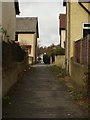
Path approaching Newlaithes Gardens
After coming up the steps from Newlay Lane and Newlaithes Road, this path levels out. Here it is passing between houses on Newlaithes Gardens, then continues to Victoria Gardens.
Image: © Rich Tea
Taken: 19 Mar 2006
0.03 miles
2
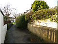
Path from Newlaithes Gardens to Victoria Gardens
The route of the footpath predates the residential development in this area, and is probably part of a much older route that leads in nearly a straight line between the sites of the ancient chapels of Bramley and Horsforth via Newlay Bridge. This section follows the line of an old field boundary (on the left).
Image: © Stephen Craven
Taken: 12 Mar 2019
0.03 miles
3
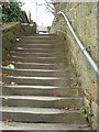
Steps from Newlaithes Road to Newlaithes Gardens
This footpath starts on Newlay Road, crosses Newlaithes Road and goes up these steps to Newlaithes Gardens.
Image: © Rich Tea
Taken: 19 Mar 2006
0.03 miles
4
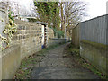
Urban footpath off Newlaithes Gardens
The path leads down to Newlaithes Road in the first instance, then onto Nelway Lane. The route of the footpath predates the residential development in this area, and is probably part of a much older route that leads in nearly a straight line between the sites of the ancient chapels of Bramley and Horsforth via Newlay Bridge. The bend here marks the location of a former field boundary.
Image: © Stephen Craven
Taken: 12 Mar 2019
0.04 miles
5
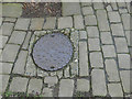
Manhole cover in a footpath
For context see Image The caster's name on the cover is that of Adams of York.
Image: © Stephen Craven
Taken: 12 Mar 2019
0.04 miles

8
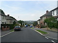
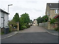
Newlaithes Gardens - viewed from Clarence Mews
Image: © Betty Longbottom
Taken: 1 Jun 2011
0.04 miles
9
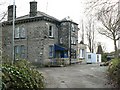
Low Wood, Clarence Road, Horsforth
Another building belonging to Barnados, just down the road from Four Gables. In 2006 the sign by the gate said "Low Wood. Learning and Development. Conference Room. Castle. Africa.
The building was demolished after 2014 and by 2020 new housing was being built as part of the Aubretia View development.
Image: © Rich Tea
Taken: 9 Apr 2006
0.04 miles
10
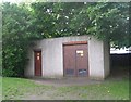
Electricity Substation No 4193 - Victoria Gardens
Image: © Betty Longbottom
Taken: 1 Jun 2011
0.04 miles