IMAGES TAKEN NEAR TO
Harrogate Road, LEEDS, LS17 9JB
Introduction
This page details the photographs taken nearby to Harrogate Road, LS17 9JB by members of the Geograph project.
The Geograph project started in 2005 with the aim of publishing, organising and preserving representative images for every square kilometre of Great Britain, Ireland and the Isle of Man.

There are currently over 7.5m images from over14,400 individuals and you can help contribute to the project by visiting https://www.geograph.org.uk
Image Map
Images are licensed for reuse under creativecommons.org/licenses/by-sa/2.0
Notes
- Clicking on the map will re-center to the selected point.
- The higher the marker number, the further away the image location is from the centre of the postcode.
Image Listing (14 Images Found)
Images are licensed for reuse under creativecommons.org/licenses/by-sa/2.0
Image
Details
Distance

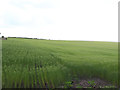
2
Harewood House
The southern gateway to Harewood House stands next to Millfield Farm on the main Leeds to Harrogate road.
Image: © Mick Melvin
Taken: 22 Jun 2005
0.02 miles
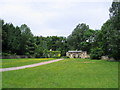
3
Entrance to High Wood
The southern gateway and lodge buildings to the Harewood Estate from the A61, by Millfield Farm
Image: © Chris Heaton
Taken: 24 Jan 2015
0.05 miles
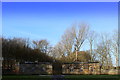
5
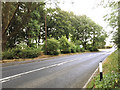
A61 north of Alwoodley
Looking north-east towards Harrogate from the junction with Manor House Lane Image
Image: © Stephen Craven
Taken: 5 Jul 2018
0.09 miles
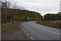
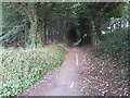
6
Bridleway off the A61 Harrogate Road, Wigton
This has been closed to motor traffic. The edges have become encroached on by vegetation and soil, but still has its central white line.
Image: © Humphrey Bolton
Taken: 12 Mar 2022
0.11 miles
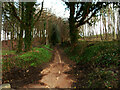
7
North end of Manor House Lane
Online maps still show this as a through road, but in fact the last few hundred metres at the northern end of the road have been closed to motor traffic in recent years. The vegetation is quickly encroaching on what is now only a pedestrian and cycle path, with the old road centre line just visible.
Image: © Stephen Craven
Taken: 5 Jul 2018
0.11 miles
8
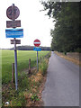
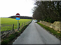
Access road to Eccup Reservoir
This private road off the A61, with bridleway status, leads to the dam, not the treatment works (which is approached from Eccup village).
Image: © Stephen Craven
Taken: 5 Jul 2018
0.12 miles
9
Access road to the Eccup Reservoir water works
This can be surprisingly busy. I parked for a few minutes at the end of the road, next to the A61, and two cars squeezed past, then another came and had to wait for me to back out before turning in.
Image: © Humphrey Bolton
Taken: 12 Mar 2022
0.12 miles