IMAGES TAKEN NEAR TO
Allerton Grange Way, LEEDS, LS17 6LP
Introduction
This page details the photographs taken nearby to Allerton Grange Way, LS17 6LP by members of the Geograph project.
The Geograph project started in 2005 with the aim of publishing, organising and preserving representative images for every square kilometre of Great Britain, Ireland and the Isle of Man.

There are currently over 7.5m images from over14,400 individuals and you can help contribute to the project by visiting https://www.geograph.org.uk
Image Map (Loading...)


Getting Data...Please wait
Leaflet Map data © OpenStreetMap
Images are licensed for reuse under creativecommons.org/licenses/by-sa/2.0
Notes
- Clicking on the map will re-center to the selected point.
- The higher the marker number, the further away the image location is from the centre of the postcode.
Image Listing (78 Images Found)
Images are licensed for reuse under creativecommons.org/licenses/by-sa/2.0
Image
Details
Distance
1

Postbox on Allerton Grange Way
The postbox is marked GR (but not G VI R) i.e. George V who reigned until 1936. But the 1936 OS map does not show this road; even the 1947 map shows the road laid out but few houses yet. It's just possible that the road was made in 1935/36 before the King's death and before the Ordnance Survey picked it up, with the postbox being installed very early in the residential development. Or else it has been relocated from elsewhere.
Image: © Stephen Craven
Taken: 27 Jul 2024
0.04 miles
2
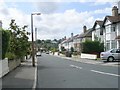
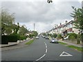
Allerton Grange Drive - Allerton Grange Rise
Image: © Betty Longbottom
Taken: 17 Aug 2009
0.06 miles
3

Allerton Grange Park
Placeholder image for a panorama to be submitted after moderation.
Image: © Stephen Craven
Taken: 27 Jul 2024
0.06 miles
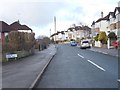
5
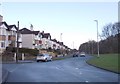
Stainburn Mount - Allerton Grange Way
Image: © Betty Longbottom
Taken: 17 Aug 2009
0.07 miles
6

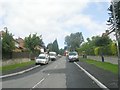
Van on Allerton Grange Way
The van is marked '0800 REPAIR'. No other contact details are given; I presume the actual number is 0800 737247, corresponding to the letters on phone keypads (which date back to the days of rotary dial phones!)
Image: © Stephen Craven
Taken: 27 Jul 2024
0.08 miles
7
Allerton Grange Way - Gledhow Valley Road
Image: © Betty Longbottom
Taken: 1 Feb 2013
0.08 miles
8

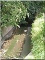
CSO on Allerton Grange Way
The blue Yorkshire Water label on the left hand cabinet identifies the installation as a CSO (combined sewer overflow), in this instance into the beck that runs through the trees (and thence via Gledhow Valley into Gipton Beck, Sheepscar Beck and eventually the river Aire).
Image: © Stephen Craven
Taken: 27 Jul 2024
0.08 miles
9
Allerton Grange Rise - Allerton Grange Way
Image: © Betty Longbottom
Taken: 17 Aug 2009
0.09 miles
10
Allerton Grange Vale - Allerton Grange Way
Image: © Betty Longbottom
Taken: 1 Feb 2013
0.09 miles