IMAGES TAKEN NEAR TO
St. Johns Avenue, LEEDS, LS14 3BZ
Introduction
This page details the photographs taken nearby to St. Johns Avenue, LS14 3BZ by members of the Geograph project.
The Geograph project started in 2005 with the aim of publishing, organising and preserving representative images for every square kilometre of Great Britain, Ireland and the Isle of Man.

There are currently over 7.5m images from over14,400 individuals and you can help contribute to the project by visiting https://www.geograph.org.uk
Image Map
Images are licensed for reuse under creativecommons.org/licenses/by-sa/2.0
Notes
- Clicking on the map will re-center to the selected point.
- The higher the marker number, the further away the image location is from the centre of the postcode.
Image Listing (85 Images Found)
Images are licensed for reuse under creativecommons.org/licenses/by-sa/2.0
Image
Details
Distance
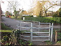
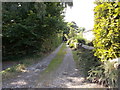
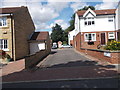
4
Littlemoor Lane, Thorner
A public footpath, heading south-east from the village. The large-scale OS map surveyed in 1845-47 shows this lane leading to the now vanished Little Moor House.
Image: © Christine Johnstone
Taken: 15 Aug 2023
0.06 miles
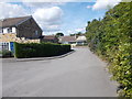
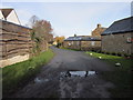
6
St John's Court - St John's Avenue
Image: © Betty Longbottom
Taken: 17 Aug 2015
0.07 miles
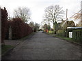
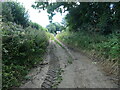
7
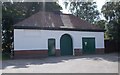
Electricity Substation No 257 - end of Butts Garth
Image: © Betty Longbottom
Taken: 17 Aug 2015
0.07 miles