IMAGES TAKEN NEAR TO
Rossefield Approach, LEEDS, LS13 3RG
Introduction
This page details the photographs taken nearby to Rossefield Approach, LS13 3RG by members of the Geograph project.
The Geograph project started in 2005 with the aim of publishing, organising and preserving representative images for every square kilometre of Great Britain, Ireland and the Isle of Man.

There are currently over 7.5m images from over14,400 individuals and you can help contribute to the project by visiting https://www.geograph.org.uk
Image Map
Images are licensed for reuse under creativecommons.org/licenses/by-sa/2.0
Notes
- Clicking on the map will re-center to the selected point.
- The higher the marker number, the further away the image location is from the centre of the postcode.
Image Listing (365 Images Found)
Images are licensed for reuse under creativecommons.org/licenses/by-sa/2.0
Image
Details
Distance
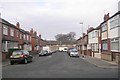
1
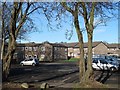
Rossefield Place car park
The line of trees in the foreground marks the Southern boundary of the Rossefield estate.
Image: © Stephen Craven
Taken: 14 Feb 2016
0.03 miles
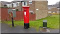
2
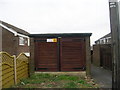
Electricity Substation No 3796 - Rossefield Grove
Image: © Betty Longbottom
Taken: 4 Apr 2011
0.03 miles
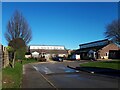
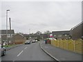
3
Substation, Rossefield Approach, Bramley
Part of the Rossefield estate to the left.
Image: © Stephen Craven
Taken: 14 Feb 2016
0.04 miles
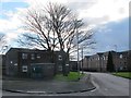
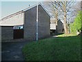
4
Rossedene, Railsfield Way
This pair of low-rise buildings provides some kind of residential social care.
Image: © Stephen Craven
Taken: 14 Jan 2022
0.04 miles
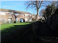
6
Footpath behind Rossefield Close
The path marks part of the Southern boundary of the Rossefield estate.
Image: © Stephen Craven
Taken: 14 Feb 2016
0.04 miles
7
Rossefield Approach - Rossefield Grove
Image: © Betty Longbottom
Taken: 4 Apr 2011
0.04 miles
8
The Long Ginnel, Bramley
The path marks the Southern boundary of the Rossefield estate. The Leodis website https://www.leodis.net/SearchResults?ImageID=20031014_18139285 suggests that this historic route was known locally as the Long Ginnel.
Image: © Stephen Craven
Taken: 14 Feb 2016
0.04 miles
10
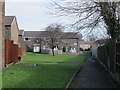
Footpath along the backs of houses on Rossefield Grove
Comparison with old maps shows that this route follows an old field boundary, though any right of way would appear to be a matter of customary use since the estate was built.
Image: © Stephen Craven
Taken: 14 Feb 2016
0.05 miles