IMAGES TAKEN NEAR TO
Wilfrid Terrace, LEEDS, LS12 5DE
Introduction
This page details the photographs taken nearby to Wilfrid Terrace, LS12 5DE by members of the Geograph project.
The Geograph project started in 2005 with the aim of publishing, organising and preserving representative images for every square kilometre of Great Britain, Ireland and the Isle of Man.

There are currently over 7.5m images from over14,400 individuals and you can help contribute to the project by visiting https://www.geograph.org.uk
Image Map
Images are licensed for reuse under creativecommons.org/licenses/by-sa/2.0
Notes
- Clicking on the map will re-center to the selected point.
- The higher the marker number, the further away the image location is from the centre of the postcode.
Image Listing (155 Images Found)
Images are licensed for reuse under creativecommons.org/licenses/by-sa/2.0
Image
Details
Distance
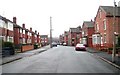
1
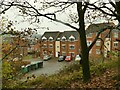
Wilfrid Terrace
Possibly named after the church of St Wilfrid about half a mile away. Viewed from the old railway embankment.
Image: © Stephen Craven
Taken: 29 Nov 2020
0.02 miles
3
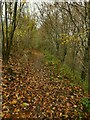
Course of the old Farnley ironworks railway
The Farnley ironworks (later fireclay works) was a large industrial site on the edge of Leeds. I haven't established when it closed, but most of the site is now occupied by the Whitehall industrial estate. It was served by this railway line, which was shown on the 1908 maps as "LNWR Farnley Branch". The freight line also served the Dunlop and Ranken steelworks the other side of Whitehall Road, apparently until c.1980. This length of the trackbed north of Whitehall Road is walkable.
Image: © Stephen Craven
Taken: 29 Nov 2020
0.03 miles
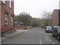
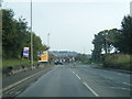
4
Steps down to Whitehall Road
The steps lead down from a former railway embankment. It can't be walked beyond this to the south-east as the bridge over Whitehall Road has long been demolished.
Image: © Stephen Craven
Taken: 29 Nov 2020
0.03 miles
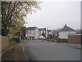
6
Cow Close Road, New Blackpool, Leeds
A closer view of the postbox can be seen here: Image
Image: © Mark Anderson
Taken: 14 Jun 2017
0.04 miles
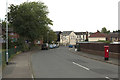
9
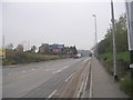
Whitehall Road - viewed from Branch Road
Image: © Betty Longbottom
Taken: 16 Nov 2011
0.04 miles
10
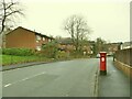
Postbox on Cow Close Road
See Image for a close look.
Image: © Stephen Craven
Taken: 29 Nov 2020
0.04 miles