
IMAGES TAKEN NEAR TO
Ty'N Coed Uchaf, LLANGEFNI, LL77 8WB
Introduction
This page details the photographs taken nearby to Ty'N Coed Uchaf, LL77 8WB by members of the Geograph project.
The Geograph project started in 2005 with the aim of publishing, organising and preserving representative images for every square kilometre of Great Britain, Ireland and the Isle of Man.

There are currently over 7.5m images from over14,400 individuals and you can help contribute to the project by visiting https://www.geograph.org.uk
Image Map
Images are licensed for reuse under creativecommons.org/licenses/by-sa/2.0
Notes
- Clicking on the map will re-center to the selected point.
- The higher the marker number, the further away the image location is from the centre of the postcode.
Image Listing (12 Images Found)
Images are licensed for reuse under creativecommons.org/licenses/by-sa/2.0
Image
Details
Distance
1
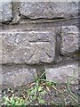
Benchmark on Pont Clai, Llangefni
This benchmark is located on the NW parapet of Pont Clai in Llangefni. The mark is not shown in the current Ordnance Survey database but is shown on an 1969 map of the area as being at a height of 58.05ft.
Image: © Meirion
Taken: 11 Jan 2011
0.13 miles
2
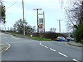
Road junction north of Llangefni
The road junction of the B5110 and the B5111, to the north of Llangefni
Image: © Nigel Williams
Taken: 15 Apr 2006
0.16 miles
3
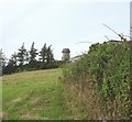
Melin y Graig Corn Mill
This disused mill was built in 1828. The mill has found a new use - as a mast for mobile telephone aerials.
Image: © Eric Jones
Taken: 21 Jul 2008
0.19 miles
4
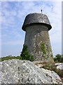
Old Windmill, Llangefni
Situated on the western edge of the town, this old mill has a new roof and a new use as a telecommunications tower. SH465758.
Image: © Keith Williamson
Taken: 27 Jul 2005
0.20 miles
5
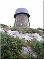
Melin Wynt Y Graig
Thought to have been built in 1829, it closed in 1893. Now used for telecommunications.
Image: © Chris Andrews
Taken: 20 Sep 2014
0.21 miles
6
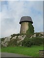
Old windmill, new use
Standing on a low crag in Llangefni, this former windmill is now used for telecommunications.
Image: © Gordon Hatton
Taken: 25 Sep 2023
0.21 miles
7
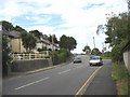
1930s ribbon development of bungalows in Lon Las
Image: © Eric Jones
Taken: 4 Jul 2008
0.21 miles
8
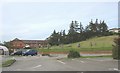
Ysbyty Cefni Hospital
This recently built community hospital stands behind the Somerfield supermarket. It replaced two out-dated unit, the Druid and Cefni Hospitals.
Image: © Eric Jones
Taken: 21 Jul 2008
0.23 miles
9
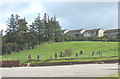
The Gorsedd Stones and Disused Windmill at Pencraig
The stone circle is considerably younger than the mill. Consisting of a ring of upright stones surrounding an altar slab (Y Maen Llog), it is where the Eisteddfodic Druids conduct their slightly comical masonic-based rituals. At least these stones are real. In recent times rising costs have led to the introduction of tacky looking plastic stones. The link shows a photo of the circle taken by Francis Frith Ltd c.1960 long before the houses were built.
http://www.francisfrith.com/search/wales/gwynedd/llangefni/photos/llangefni_L364060.htm
Image: © Eric Jones
Taken: 13 Sep 2008
0.24 miles
10
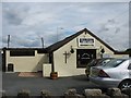
M Rowlands Funeral Directors, Church Street
Image: © Eric Jones
Taken: 4 Jul 2008
0.25 miles