Melin Wynt Y Graig
Introduction
The photograph on this page of Melin Wynt Y Graig by Chris Andrews as part of the Geograph project.
The Geograph project started in 2005 with the aim of publishing, organising and preserving representative images for every square kilometre of Great Britain, Ireland and the Isle of Man.

There are currently over 7.5m images from over 14,400 individuals and you can help contribute to the project by visiting https://www.geograph.org.uk
Melin Wynt Y Graig
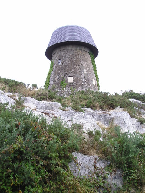
Image: © Chris Andrews Taken: 20 Sep 2014
Thought to have been built in 1829, it closed in 1893. Now used for telecommunications.
Images are licensed for reuse under creativecommons.org/licenses/by-sa/2.0
Image Location
Latitude
53.25666
Longitude
-4.302962