Benchmark on Pont Clai, Llangefni
Introduction
The photograph on this page of Benchmark on Pont Clai, Llangefni by Meirion as part of the Geograph project.
The Geograph project started in 2005 with the aim of publishing, organising and preserving representative images for every square kilometre of Great Britain, Ireland and the Isle of Man.

There are currently over 7.5m images from over 14,400 individuals and you can help contribute to the project by visiting https://www.geograph.org.uk
Benchmark on Pont Clai, Llangefni
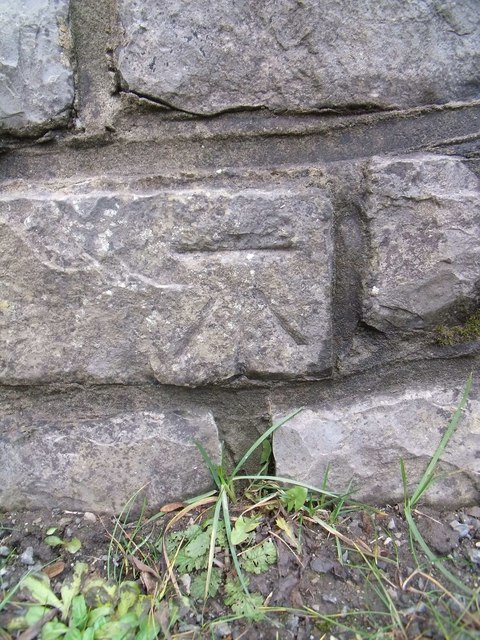
Image: © Meirion Taken: 11 Jan 2011
This benchmark is located on the NW parapet of Pont Clai in Llangefni. The mark is not shown in the current Ordnance Survey database but is shown on an 1969 map of the area as being at a height of 58.05ft.
Images are licensed for reuse under creativecommons.org/licenses/by-sa/2.0
Image Location
Latitude
53.260616
Longitude
-4.307598