
IMAGES TAKEN NEAR TO
Dol Eithin, HOLYHEAD, LL65 3NF
Introduction
This page details the photographs taken nearby to Dol Eithin, LL65 3NF by members of the Geograph project.
The Geograph project started in 2005 with the aim of publishing, organising and preserving representative images for every square kilometre of Great Britain, Ireland and the Isle of Man.

There are currently over 7.5m images from over14,400 individuals and you can help contribute to the project by visiting https://www.geograph.org.uk
Image Map
Images are licensed for reuse under creativecommons.org/licenses/by-sa/2.0
Notes
- Clicking on the map will re-center to the selected point.
- The higher the marker number, the further away the image location is from the centre of the postcode.
Image Listing (17 Images Found)
Images are licensed for reuse under creativecommons.org/licenses/by-sa/2.0
Image
Details
Distance
1
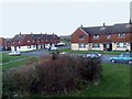
Houses at Llanfihangel yn Nhowyn
Housing estate at Llanfihangel yn Nhowyn
Image: © Nigel Williams
Taken: 9 Feb 2006
0.07 miles
3
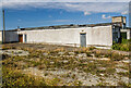
WWII Defences of North Wales: RAF Valley - Operations Block (3)
-
RAF Valley wartime Sector Operations Block
The actual operations room would have been contained within the raised roof-line section of the building, and was the nerve centre of operational activity.
Image
Image: © Mike Searle
Taken: 4 Aug 2021
0.13 miles
4
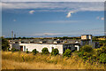
WWII Defences of North Wales: RAF Valley - Operations Block (2)
-
RAF Valley wartime Sector Operations Block
This purpose-built building was RAF Valley's Sector Operations Block during the Second World War, whose role was plotting the movements of enemy aircraft, and directing our own fighter aircraft against them. Today the building has found an alternative non-military use as a depot for highway maintenance vehicles.
Image
Image: © Mike Searle
Taken: 4 Aug 2021
0.13 miles
5
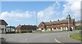
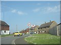
Housing estate in Llanfihangel-yn-Nhowyn
Image: © Eric Jones
Taken: 14 Apr 2008
0.16 miles
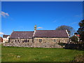
7
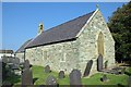
Eglwys St. Mihangel's Church
Eglwys St.Mihangel, the RAF Church - used as the Anglican and Scottish Free Church place of worship.
Image: © Arthur C Harris
Taken: 11 Sep 2014
0.17 miles
8
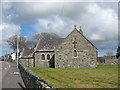
St Mihangel from the west
Mihangel is pronounced "Mee-hang-el"
Image
Image: © Eric Jones
Taken: 14 Apr 2008
0.17 miles
9
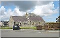
St Mihangel's Church, Llanfihangel-yn-Nhowyn
Image: © Eric Jones
Taken: 14 Apr 2008
0.17 miles
10
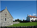
The Anglican church of St Michael's in the Dune
The decommissioned Church in Wales parish church of Llanfihangel-yn-Nhywyn (=the church of St Michael's in the dune) has been adopted by the RAF as the Anglican church for both RAF Valley and the married quarters estates which form the bulk of the village. It stands at the centre of the village.
Image: © Eric Jones
Taken: 8 Aug 2007
0.17 miles