The Anglican church of St Michael's in the Dune
Introduction
The photograph on this page of The Anglican church of St Michael's in the Dune by Eric Jones as part of the Geograph project.
The Geograph project started in 2005 with the aim of publishing, organising and preserving representative images for every square kilometre of Great Britain, Ireland and the Isle of Man.

There are currently over 7.5m images from over 14,400 individuals and you can help contribute to the project by visiting https://www.geograph.org.uk
The Anglican church of St Michael's in the Dune
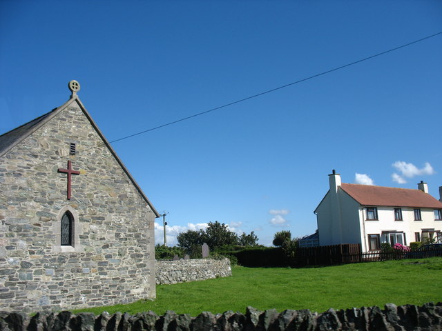
Image: © Eric Jones Taken: 8 Aug 2007
The decommissioned Church in Wales parish church of Llanfihangel-yn-Nhywyn (=the church of St Michael's in the dune) has been adopted by the RAF as the Anglican church for both RAF Valley and the married quarters estates which form the bulk of the village. It stands at the centre of the village.
Images are licensed for reuse under creativecommons.org/licenses/by-sa/2.0
Image Location
Latitude
53.267129
Longitude
-4.518729