IMAGES TAKEN NEAR TO
Llanfaes, BEAUMARIS, LL58 8LW
Introduction
This page details the photographs taken nearby to LL58 8LW by members of the Geograph project.
The Geograph project started in 2005 with the aim of publishing, organising and preserving representative images for every square kilometre of Great Britain, Ireland and the Isle of Man.

There are currently over 7.5m images from over14,400 individuals and you can help contribute to the project by visiting https://www.geograph.org.uk
Image Map
Images are licensed for reuse under creativecommons.org/licenses/by-sa/2.0
Notes
- Clicking on the map will re-center to the selected point.
- The higher the marker number, the further away the image location is from the centre of the postcode.
Image Listing (12 Images Found)
Images are licensed for reuse under creativecommons.org/licenses/by-sa/2.0
Image
Details
Distance
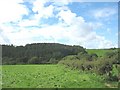
1
Wooded scarp marking the eastern end of the belt of Pre-Cambrian Monian rocks
Image: © Eric Jones
Taken: 22 Aug 2008
0.13 miles
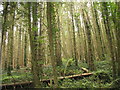
2
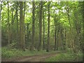
Coed Bach woodland
Coed Bach is a part of the woodland belt which extends along the escarpment from Menai Bridge to Llangoed.
Image: © Eric Jones
Taken: 23 Aug 2008
0.15 miles
5
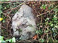
Old Boundary Marker
Parish boundary marker on west side of unclassified road west of Llanfaes, 30 metres north of the drive to Nant Farm. The parish boundary is unknown but it is now entirely in Beaumaris parish.
Milestone Society National ID: ANG_BEAU04pb
Image: © D Turner
Taken: 15 Sep 2019
0.20 miles
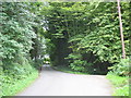
6
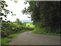
Bend in the road above Nant
The greens of the Henllys Hall golf course can be seen in the middle ground, while the Menai Strait and the Carneddau Mountains form the background.
Image: © Eric Jones
Taken: 23 Aug 2008
0.22 miles
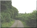
7
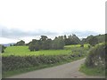
Parkland viewed from the gateway to Nant
This parkland is now used as a golfing greens.
Image: © Eric Jones
Taken: 23 Aug 2008
0.23 miles
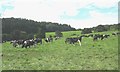
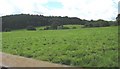
10
View across pasture land to forested scarp
Image: © Eric Jones
Taken: 22 Aug 2008
0.24 miles