
IMAGES TAKEN NEAR TO
New Gerlan Road, BANGOR, LL57 3PJ
Introduction
This page details the photographs taken nearby to New Gerlan Road, LL57 3PJ by members of the Geograph project.
The Geograph project started in 2005 with the aim of publishing, organising and preserving representative images for every square kilometre of Great Britain, Ireland and the Isle of Man.

There are currently over 7.5m images from over14,400 individuals and you can help contribute to the project by visiting https://www.geograph.org.uk
Image Map
Images are licensed for reuse under creativecommons.org/licenses/by-sa/2.0
Notes
- Clicking on the map will re-center to the selected point.
- The higher the marker number, the further away the image location is from the centre of the postcode.
Image Listing (74 Images Found)
Images are licensed for reuse under creativecommons.org/licenses/by-sa/2.0
Image
Details
Distance
1
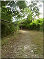
The Beginning of a steep footpath between Pant and Bont Uchaf, Pant
This is the beginning of a short but very steep footpath starting on Gerlan New Road in Pant and leading to Ffordd Carneddi in Bont uchaf.
Image: © Meirion
Taken: 5 Aug 2016
0.04 miles
2
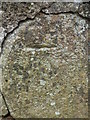
Benchmark on Ffordd Carneddi, Bont Uchaf
A benchmark on Ffordd Carneddi in Bont Uchaf. For more info see: http://www.bench-marks.org.uk/bm78029
Image: © Meirion
Taken: 4 Aug 2016
0.05 miles
3
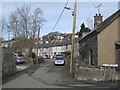
Glanrafon road junction
Clustered, slate rooves on may levels typify the steep streets of Bontuchaf.
Image: © Jonathan Wilkins
Taken: 9 Mar 2018
0.06 miles
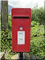
5
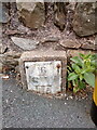
Sluice valve marker at crossroads, Bethesda
Image: © Meirion
Taken: 15 May 2020
0.07 miles
6
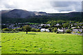
Grassy hillside above Bethesda
The spire of Christ Church Glanogwen is down to the right, while opposite are the Penrhyn slate quarries which stimulated much of the development of the town.
Image: © Bill Boaden
Taken: 18 Sep 2015
0.07 miles
7
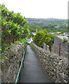
Short-cut into town
Bethesda has a maze of footpaths and alleys linking the town centre with the terraces on the hillside above. This tarraed path links Ffordd Carneddi and Ffrydlas Road.
Image: © Eric Jones
Taken: 11 May 2007
0.09 miles
8
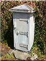
Electrical cabinet on Carneddi Road, Bethesda
Image: © Meirion
Taken: 5 Jun 2020
0.09 miles
9
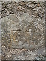
Benchmark on cottage wall on Glanrafon, Bont Uchaf
This benchmark is located at on the south wall of a small cottage on Glanrafon in Bont Uchaf. The mark is not shown in the current Ordnance Survey database but is shown on an 1889 map of the area as being 681.3ft above the Liverpool datum. For more info see: http://www.bench-marks.org.uk/bm78030
Image: © Meirion
Taken: 4 Aug 2016
0.10 miles
10
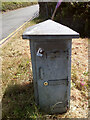
Electrical cabinet on Ffordd Gerlan, Bethesda
Image: © Meirion
Taken: 5 Jun 2020
0.11 miles