Benchmark on cottage wall on Glanrafon, Bont Uchaf
Introduction
The photograph on this page of Benchmark on cottage wall on Glanrafon, Bont Uchaf by Meirion as part of the Geograph project.
The Geograph project started in 2005 with the aim of publishing, organising and preserving representative images for every square kilometre of Great Britain, Ireland and the Isle of Man.

There are currently over 7.5m images from over 14,400 individuals and you can help contribute to the project by visiting https://www.geograph.org.uk
Benchmark on cottage wall on Glanrafon, Bont Uchaf
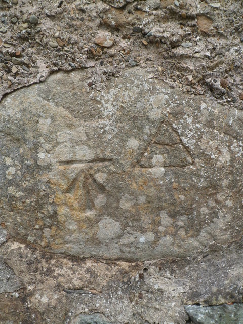
Image: © Meirion Taken: 4 Aug 2016
This benchmark is located at on the south wall of a small cottage on Glanrafon in Bont Uchaf. The mark is not shown in the current Ordnance Survey database but is shown on an 1889 map of the area as being 681.3ft above the Liverpool datum. For more info see: http://www.bench-marks.org.uk/bm78030
Images are licensed for reuse under creativecommons.org/licenses/by-sa/2.0
Image Location
Latitude
53.180123
Longitude
-4.052102