
IMAGES TAKEN NEAR TO
Clynnog Road, CAERNARFON, LL54 6NS
Introduction
This page details the photographs taken nearby to Clynnog Road, LL54 6NS by members of the Geograph project.
The Geograph project started in 2005 with the aim of publishing, organising and preserving representative images for every square kilometre of Great Britain, Ireland and the Isle of Man.

There are currently over 7.5m images from over14,400 individuals and you can help contribute to the project by visiting https://www.geograph.org.uk
Image Map
Images are licensed for reuse under creativecommons.org/licenses/by-sa/2.0
Notes
- Clicking on the map will re-center to the selected point.
- The higher the marker number, the further away the image location is from the centre of the postcode.
Image Listing (38 Images Found)
Images are licensed for reuse under creativecommons.org/licenses/by-sa/2.0
Image
Details
Distance
1
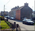
Ffordd Clynnog, Penygroes
Located on the west side of the A487.
Image: © Jaggery
Taken: 24 Mar 2012
0.02 miles
3
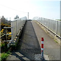
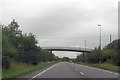
Footbridge over the A487, Penygroes
Located at the western edge of the village.
Image: © Jaggery
Taken: 24 Mar 2012
0.07 miles
4
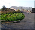
A487 footbridge, Penygroes
Viewed from the eastern side of the bridge, near West End. http://www.geograph.org.uk/photo/3465026
Image: © Jaggery
Taken: 24 Mar 2012
0.08 miles
5
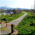
Path alongside the A487, Penygroes
Viewed from the eastern end of a footbridge http://www.geograph.org.uk/photo/3465032 over the A487.
Image: © Jaggery
Taken: 24 Mar 2012
0.08 miles
6

View of Snowdon from near Penygroes
Taken approx 1/2 km west of Penygroes, with Mynydd Mawr (left) & Mynydd (right)
Image: © Ian Warburton
Taken: 9 Apr 2006
0.08 miles
8
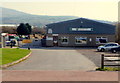
Wynnstay stores, Penygroes
Set back from the south side of Station Road, alongside the A487.
Wynnstay manufactures and supplies a wide range of agricultural products.
A 1940s map shows that this was the location of Penygroes railway station which closed in 1964.
Image: © Jaggery
Taken: 24 Mar 2012
0.09 miles
9
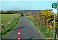
L?n Eifion Cycleway, Penygroes
Viewed from the western edge of this http://www.geograph.org.uk/photo/3465052 footbridge. Part of National Cycle Network Route 8,
Lôn Eifion Cycleway extends from Caernarfon to Bryncir. This is part of the Penygroes section alongside the A487.
Image: © Jaggery
Taken: 24 Mar 2012
0.10 miles
10
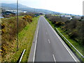
A view south along the A487, Penygroes
Viewed from this http://www.geograph.org.uk/photo/3465032 footbridge near the site of the former Penygroes railway station, which closed in 1964. The A487 here uses the trackbed of the dismantled railway.
Image: © Jaggery
Taken: 24 Mar 2012
0.11 miles