
IMAGES TAKEN NEAR TO
Corn Hill, PORTHMADOG, LL49 9AT
Introduction
This page details the photographs taken nearby to Corn Hill, LL49 9AT by members of the Geograph project.
The Geograph project started in 2005 with the aim of publishing, organising and preserving representative images for every square kilometre of Great Britain, Ireland and the Isle of Man.

There are currently over 7.5m images from over14,400 individuals and you can help contribute to the project by visiting https://www.geograph.org.uk
Image Map
Images are licensed for reuse under creativecommons.org/licenses/by-sa/2.0
Notes
- Clicking on the map will re-center to the selected point.
- The higher the marker number, the further away the image location is from the centre of the postcode.
Image Listing (1193 Images Found)
Images are licensed for reuse under creativecommons.org/licenses/by-sa/2.0
Image
Details
Distance
1
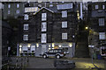
Ty Toronto
Ty Toronto was built in 1836 and is shown on the 1842 Tithe map and 1871 Tremadog estate plan. The lower storey was originally the North & South Wales Bank, then Casson's Bank from 1847, until it was taken over by William and Richard Prichard, ship owners and brokers, in 1865. The upper storeys were a sail loft (Jones & Jones and Richards & Jones are both listed as Cornhill sailmakers in 1871) and, from at least 1844, housed William Griffiths' Navigation School. The building was converted to apartments in the late C20.*
* Information courtesy British Listed Buildings.
Image: © Arthur C Harris
Taken: 16 Dec 2018
0.01 miles
4
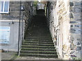
Grisiau Mawr
Grisiau Mawr (the big steps) were constructed to connect the former business and slate quay areas with the middle-class residences high up on Ffordd y Garth.
Image: © Alan Fryer
Taken: 17 Nov 2011
0.02 miles
5
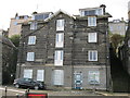
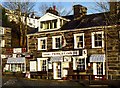
Tŷ Toronto
A large, former commercial building facing the quayside, now converted into flats.
Image to the right of the picture.
Image: © Alan Fryer
Taken: 17 Nov 2011
0.02 miles
6
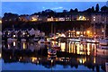
Porthmadog Harbour at Dusk
The water was so still it was almost a mirror image.
Image: © Christine Matthews
Taken: 15 Apr 2011
0.02 miles
7
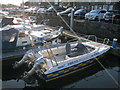
Cwch yr harbwr feister - Harbourmaster's launch
Image: © Alan Fryer
Taken: 14 Jan 2012
0.02 miles
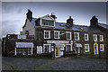
9
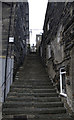
Grisiau Mawr
Steps believed to have been built in mid C19 to connect the harbour to Garth Road.
Image: © Arthur C Harris
Taken: 20 Dec 2018
0.02 miles
10
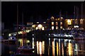
Porthmadog Harbour at Night
As seen from close to the station.
Image: © Christine Matthews
Taken: 15 Apr 2011
0.02 miles