Grisiau Mawr
Introduction
The photograph on this page of Grisiau Mawr by Arthur C Harris as part of the Geograph project.
The Geograph project started in 2005 with the aim of publishing, organising and preserving representative images for every square kilometre of Great Britain, Ireland and the Isle of Man.

There are currently over 7.5m images from over 14,400 individuals and you can help contribute to the project by visiting https://www.geograph.org.uk
Grisiau Mawr
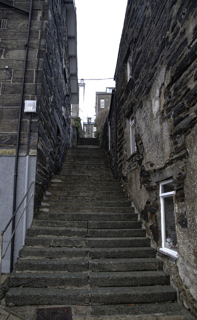
Image: © Arthur C Harris Taken: 20 Dec 2018
Steps believed to have been built in mid C19 to connect the harbour to Garth Road.
Images are licensed for reuse under creativecommons.org/licenses/by-sa/2.0
Image Location
Latitude
52.923333
Longitude
-4.131098