IMAGES TAKEN NEAR TO
Gerddi Gledhill, LLANDUDNO, LL30 1GG
Introduction
This page details the photographs taken nearby to Gerddi Gledhill, LL30 1GG by members of the Geograph project.
The Geograph project started in 2005 with the aim of publishing, organising and preserving representative images for every square kilometre of Great Britain, Ireland and the Isle of Man.

There are currently over 7.5m images from over14,400 individuals and you can help contribute to the project by visiting https://www.geograph.org.uk
Image Map
Images are licensed for reuse under creativecommons.org/licenses/by-sa/2.0
Notes
- Clicking on the map will re-center to the selected point.
- The higher the marker number, the further away the image location is from the centre of the postcode.
Image Listing (13 Images Found)
Images are licensed for reuse under creativecommons.org/licenses/by-sa/2.0
Image
Details
Distance

5
Summit rocks
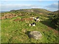
Gorse has covered most of the rock outcrop, but there are a few places where the rhyolite shows through. The rock is an interesting, nodular tuff which is also found in outcrops on the south of the Vardre in Deganwy (see Image). Because it is resistant to erosion there is high ground with poor soil developed where it is present. Here there is also a fine erratic boulder, which shows that ice was at least as high as this point during the last glaciation.
Image: © Jonathan Wilkins
Taken: 31 Oct 2020
0.14 miles
6
Ordnance Survey bolt in rock trigpoint - Cwm Howard, Llandudno
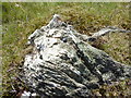
This small bolt protruding from a rocky outcrop on Cwm Howard is recorded in the Ordnance Survey database as a trigpoint.
Although the coordinates for this trigpoint are recorded in the OS database no height information is given. My GPS gave a height of 95m.
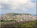
Some excellent views of Llandudno & the Orme from here.
Image: © Meirion
Taken: 19 May 2011
0.14 miles
8
Bryniau footpath
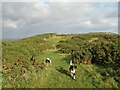
A footpath runs along the crest of the hill, which is overgrown with invading gorse.
Image: © Jonathan Wilkins
Taken: 31 Oct 2020
0.16 miles
9
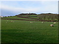
Bryniau
The fields of Bryniau farm, and on the skyline is a ruined watch tower.
Image: © Eirian Evans
Taken: 28 Jan 2012
0.16 miles