Ordnance Survey bolt in rock trigpoint - Cwm Howard, Llandudno
Introduction
The photograph on this page of Ordnance Survey bolt in rock trigpoint - Cwm Howard, Llandudno by Meirion as part of the Geograph project.
The Geograph project started in 2005 with the aim of publishing, organising and preserving representative images for every square kilometre of Great Britain, Ireland and the Isle of Man.

There are currently over 7.5m images from over 14,400 individuals and you can help contribute to the project by visiting https://www.geograph.org.uk
Ordnance Survey bolt in rock trigpoint - Cwm Howard, Llandudno
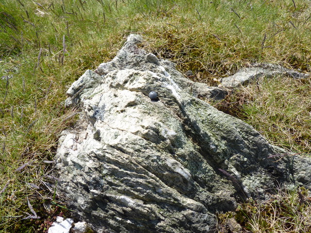
Image: © Meirion Taken: 19 May 2011
This small bolt protruding from a rocky outcrop on Cwm Howard is recorded in the Ordnance Survey database as a trigpoint. Although the coordinates for this trigpoint are recorded in the OS database no height information is given. My GPS gave a height of 95m. Some excellent views of Llandudno & the Orme from here.
Images are licensed for reuse under creativecommons.org/licenses/by-sa/2.0
Image Location
Latitude
53.308914
Longitude
-3.82107