IMAGES TAKEN NEAR TO
Gorse Close, WREXHAM, LL14 6BZ
Introduction
This page details the photographs taken nearby to Gorse Close, LL14 6BZ by members of the Geograph project.
The Geograph project started in 2005 with the aim of publishing, organising and preserving representative images for every square kilometre of Great Britain, Ireland and the Isle of Man.

There are currently over 7.5m images from over14,400 individuals and you can help contribute to the project by visiting https://www.geograph.org.uk
Image Map
Images are licensed for reuse under creativecommons.org/licenses/by-sa/2.0
Notes
- Clicking on the map will re-center to the selected point.
- The higher the marker number, the further away the image location is from the centre of the postcode.
Image Listing (17 Images Found)
Images are licensed for reuse under creativecommons.org/licenses/by-sa/2.0
Image
Details
Distance
1
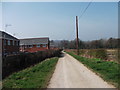
Footpath to Pentre-clawdd
The footpath uses the access drive to Pentre-clawdd. The houses on the left were built on a greenfield site.
Image: © John Haynes
Taken: 24 Mar 2012
0.07 miles
2
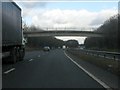
A483 - Pentre-clawydd accommodation bridge
Image: © Peter Whatley
Taken: 18 Jan 2011
0.07 miles
3
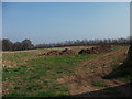
Farmyard manure waiting to be spread
The manure has been unloaded in the field ready to be spread on the maize stubble. When spreading has been completed the field will be ploughed and then probably sown to maize again.
Image: © John Haynes
Taken: 24 Mar 2012
0.07 miles
4
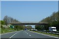
Farm bridge with public footpath over A483
Image: © David Smith
Taken: 23 Apr 2015
0.08 miles
5
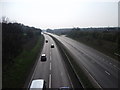
The A483 southward
The A483 joins the A5 at Halton and then onward to Shrewsbury. This view is from the accommodation bridge to Pentre-clawdd. Image]
Image: © John Haynes
Taken: 24 Mar 2012
0.08 miles
8
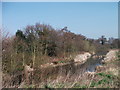
Afon Goch
This river was a drain for various colliery pumps in the area and was called Black Brook because of its colour. It has been widened and made to provide a storm drain receptor for the nearby new housing estate.
Image: © John Haynes
Taken: 24 Mar 2012
0.10 miles
9
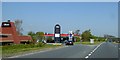
Restaurant and Esso filling station, A483, Ruabon
Image: © David Smith
Taken: 23 Apr 2015
0.11 miles