IMAGES TAKEN NEAR TO
Barr Road, LEICESTER, LE7 2BS
Introduction
This page details the photographs taken nearby to Barr Road, LE7 2BS by members of the Geograph project.
The Geograph project started in 2005 with the aim of publishing, organising and preserving representative images for every square kilometre of Great Britain, Ireland and the Isle of Man.

There are currently over 7.5m images from over14,400 individuals and you can help contribute to the project by visiting https://www.geograph.org.uk
Image Map
Images are licensed for reuse under creativecommons.org/licenses/by-sa/2.0
Notes
- Clicking on the map will re-center to the selected point.
- The higher the marker number, the further away the image location is from the centre of the postcode.
Image Listing (23 Images Found)
Images are licensed for reuse under creativecommons.org/licenses/by-sa/2.0
Image
Details
Distance

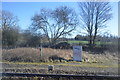
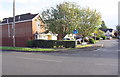
4
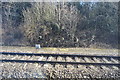
Railway
The new Weavers Lodge housing development is to the left of the railway track. The bridge in the distance is Melton Road railway bridge in Syston. Photographed looking north from Barkby Lane bridge.
Image: © Mat Fascione
Taken: 16 Jul 2007
0.12 miles
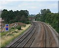
6
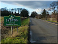
Syston sign along Barkby Lane
The sign has been changed since Image
Image: © Mat Fascione
Taken: 11 Jan 2014
0.13 miles
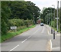
8
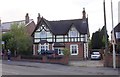
No. 1030 Melton Road, 'Kirkby House'
Ordnance Survey documents indicate that in 1978 a benchmark levelled at 54.430m above Newlyn Datum was verified on the wall in front of the house just left of the telegraph pole at the right hand side of the entrance. It seems likely that the entrance has been widened with loss of the mark.
Image: © phil Richards
Taken: 21 Sep 2017
0.19 miles
9
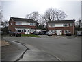
Adjunct to Miller's Close, Syston
A small cul de sac off the main cul de sac.
Image: © Richard Vince
Taken: 11 Mar 2017
0.19 miles
10
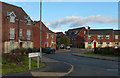
Housing at junction of Wanlip Road and Roundhill Close
This was the site of the En-Tout-Cas tennis court factory demolished in 1995. The factory had an Ordnance Survey flush bracket (serial identifier S9825) benchmark on its NW face ( www.bench-marks.org.uk/bm21691 ) and an OS triangulation station comprising a flagstaff and rivet on its roof ( http://trigpointing.uk/trig/19004 )
Image: © Roger Templeman
Taken: 11 Sep 2017
0.19 miles