IMAGES TAKEN NEAR TO
Beech Way, ASHBY-DE-LA-ZOUCH, LE65 2SR
Introduction
This page details the photographs taken nearby to Beech Way, LE65 2SR by members of the Geograph project.
The Geograph project started in 2005 with the aim of publishing, organising and preserving representative images for every square kilometre of Great Britain, Ireland and the Isle of Man.

There are currently over 7.5m images from over14,400 individuals and you can help contribute to the project by visiting https://www.geograph.org.uk
Image Map (32 Images)


Getting Data...Please wait
Leaflet Map data © OpenStreetMap
Images are licensed for reuse under creativecommons.org/licenses/by-sa/2.0
Notes
- Clicking on the map will re-center to the selected point.
- The higher the marker number, the further away the image location is from the centre of the postcode.
Image Listing (32 Images Found)
Images are licensed for reuse under creativecommons.org/licenses/by-sa/2.0
Image
Details
Distance
3
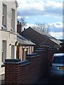
Rifle Range - Range Road
Approx 1914 drill hall for A Company, 5th Battalion, Leicestershire Regiment.
Image: © John M
Taken: 7 Mar 2014
0.11 miles
5
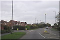
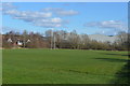
Featherbed Lane Junction, Ashby-de-la-Zouch
Image: © Roy Hughes
Taken: 31 Oct 2012
0.11 miles
6
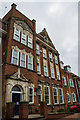
Ashby School
The front facade of the 1901 block: originally the girl's school until 1972. The school has expanded significantly recently.
Image: © Oliver Mills
Taken: 13 Oct 2016
0.13 miles
7
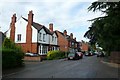
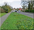
Range Road, Ashby de la Zouch
Edwardian housing in this quiet dead end close to the hospital.
Image: © Nigel Mykura
Taken: 23 Aug 2008
0.15 miles
8
Ashby School
Main entrance off Nottingham Road. See Image for one of the other sites.
http://www.ashbyschool.org.uk/about/history.php
Image: © Trevor Rickard
Taken: 15 Aug 2009
0.15 miles
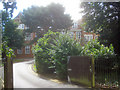
9
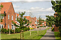
The footpath through the "Woodcock Way" housing estate, Ashby-de-la-Zouch
The accommodation of the public footpath has been provided quite well in this estate, with its original trajectory preserved and kept visually clear. The new development, viewed on maps, appears as a severe and widely unnatural spike over the existing boundaries of Nottingham Road's housing; perhaps making it more acceptable to continue development of this land in the future than it otherwise would be.
Image: © Oliver Mills
Taken: 12 Aug 2021
0.18 miles
10
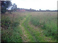
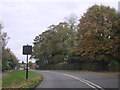
Ivanhoe Way north of Ashby
Heading west towards the houses on Woodcock Way.
Image: © Trevor Rickard
Taken: 15 Aug 2009
0.18 miles