1
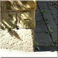
3 & 5 Hill Street, Ashby-de-la-Zouch
Brick cottages, c.1800, Listed Grade II.
Image: © Alan Murray-Rust
Taken: 5 Aug 2018
0.03 miles
2
Thatched cottage, 1 Hill Street, Ashby-de-la-Zouch
c.1800, timber framed cottages now combined into a single dwelling. Listed Grade II. The only thatched building in Ashby.
Image: © Alan Murray-Rust
Taken: 5 Aug 2018
0.05 miles
3
Gazebo, Hill Street, Ashby-de-la-Zouch
Originally part of the garden attached to The Shrubberies, probably originally part of the Mansion House grounds. At the corner of Hill Street and Kilwardby Street. 18th century, including the garden wall. Listed Grade II.
Image: © Alan Murray-Rust
Taken: 5 Aug 2018
0.05 miles
4
Ashby-de-la-Zouch junction of Burton Road and Hill Street
Image: © Chris Gunns
Taken: 10 Jun 2017
0.06 miles
5
Garden wall at Mansion House, Kilwardby Street
Contemporary with the house http://www.geograph.org.uk/photo/5872242 , Listed Grade II.
Image: © Alan Murray-Rust
Taken: 5 Aug 2018
0.07 miles
6
The Shrubberies, Kilwardby Street, Ashby-de-la-Zouch
19th century brick garden wall, Listed Grade II.
Image: © Alan Murray-Rust
Taken: 5 Aug 2018
0.07 miles
7
Ashby de la Zouch Fallen Knight Restaurant & Hotel
Hotel & Restaurant on Kilwardby Street
Image: © the bitterman
Taken: 22 Aug 2010
0.08 miles
8
Kilwardby Street, Ashby-de-la-Zouch
The main road from Moira, looking towards the town centre. It forms part of the Ivanhoe Way and Cross Britain Way long distance paths.
There is a bench mark http://www.geograph.org.uk/photo/5872248 on the corner of the wall under the tree on the left.
Image: © Alan Murray-Rust
Taken: 5 Aug 2018
0.08 miles
9
Bench mark, Kilwardby Street, Ashby-de-la-Zouch
See http://www.geograph.org.uk/photo/5872252 for location.
Image: © Alan Murray-Rust
Taken: 5 Aug 2018
0.08 miles
10
Towards Ashby town centre
Looking from the top of Kilwardby Street (near the water tower
Image), towards Market Street.
Image: © Oliver Mills
Taken: 24 Jun 2016
0.08 miles


