IMAGES TAKEN NEAR TO
Shirley Road, LEICESTER, LE2 3LJ
Introduction
This page details the photographs taken nearby to Shirley Road, LE2 3LJ by members of the Geograph project.
The Geograph project started in 2005 with the aim of publishing, organising and preserving representative images for every square kilometre of Great Britain, Ireland and the Isle of Man.

There are currently over 7.5m images from over14,400 individuals and you can help contribute to the project by visiting https://www.geograph.org.uk
Image Map
Images are licensed for reuse under creativecommons.org/licenses/by-sa/2.0
Notes
- Clicking on the map will re-center to the selected point.
- The higher the marker number, the further away the image location is from the centre of the postcode.
Image Listing (22 Images Found)
Images are licensed for reuse under creativecommons.org/licenses/by-sa/2.0
Image
Details
Distance
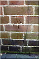
3
Damaged benchmark on #397 London Road
Ordnance Survey cut mark benchmark described on the Bench Mark Database at https://www.bench-marks.org.uk/bm102222
Image: © Roger Templeman
Taken: 8 May 2018
0.13 miles
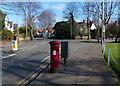
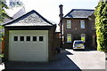
4
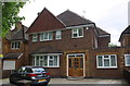
#397 London Road
There is an OS benchmark Image at the junction of the main section of the house and its single storey extension. The mark has been disturbed probably due to building works
Image: © Roger Templeman
Taken: 8 May 2018
0.13 miles
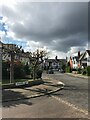
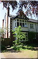
5
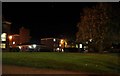
Mary Gee Accommodation
Venturing out in my slippers at 9.30pm.
This shows a small part of the accommodation at Mary Gee houses in Leicester. It is for students of the University of Leicester (including me). The single-storey room next to the chimney is the porter's office. The 'star' is in fact Jupiter.
Image]
Image: © Ashley Dace
Taken: 6 Oct 2010
0.15 miles
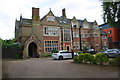
6
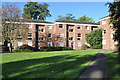
Mary Gee Accommodation
This shows a small part of the accommodation at Mary Gee houses in Leicester. It is for students of the University of Leicester (including me). My flat is just out of the picture to the right. There are only self catered facilities on site.
Image: © Ashley Dace
Taken: 17 Oct 2010
0.15 miles
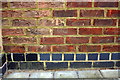
7
Benchmark on #23 Elms Road
Ordnance Survey cut mark benchmark described on the Bench Mark Database at https://www.bench-marks.org.uk/bm102221
Image: © Roger Templeman
Taken: 8 May 2018
0.17 miles
8
#23 Elms Road
There is an OS benchmark Image on the left hand side of the house near its front corner
Image: © Roger Templeman
Taken: 8 May 2018
0.17 miles
9
#39 Elms Road
There is an OS benchmark Image on the chimney breast on the left hand side of the house
Image: © Roger Templeman
Taken: 8 May 2018
0.17 miles