IMAGES TAKEN NEAR TO
Portland Towers, LEICESTER, LE2 2PG
Introduction
This page details the photographs taken nearby to Portland Towers, LE2 2PG by members of the Geograph project.
The Geograph project started in 2005 with the aim of publishing, organising and preserving representative images for every square kilometre of Great Britain, Ireland and the Isle of Man.

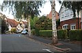
There are currently over 7.5m images from over14,400 individuals and you can help contribute to the project by visiting https://www.geograph.org.uk
Image Map
Images are licensed for reuse under creativecommons.org/licenses/by-sa/2.0
Notes
- Clicking on the map will re-center to the selected point.
- The higher the marker number, the further away the image location is from the centre of the postcode.
Image Listing (48 Images Found)
Images are licensed for reuse under creativecommons.org/licenses/by-sa/2.0
Image
Details
Distance

2

Grenfell Road at the end of Morland Avenue
Image: © David Howard
Taken: 20 Sep 2020
0.06 miles

4

Road sign for Grenfell Road, South Knighton
Image: © David Howard
Taken: 20 Sep 2020
0.08 miles
5

Knighton Grange Road, Leicester
Broad, tree lined streets are characteristic of this up-market residential area to the south east of the city centre.
Image: © Kate Jewell
Taken: 21 Dec 2005
0.10 miles

8

London Road, Oadby, Leics.
No. 453 London Road, in the vicinity of the Botanical Gardens, is the former Stoneygate Tram Depot. It has been described as a rare example of an outlying tram depot. It was built to stable and service trams on the newly extended electrified municipal tram route between the city centre and Stoneygate vicinity of Oadby, operational between 1904-1922. See: http://www.ltht.org.uk/wp-content/uploads/2016/01/Stoneygate-Tram-Depot-Key-Facts-Sheet.pdf
Image: © David Hallam-Jones
Taken: 24 Jun 2016
0.12 miles
9

Benchmark on #453 London Road (former tram depot PC)
Ordnance Survey cut mark bench mark described on the Bench Mark Database at https://www.bench-marks.org.uk/bm102226
Image: © Roger Templeman
Taken: 8 May 2018
0.12 miles