1
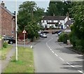
Merevale Cottages, Walton
A pair of late 19th century cottages on the green at Walton. The inscribed stone carries the name and the date 1899, plus the initials E.A.R.
Image: © Alan Murray-Rust
Taken: 25 Nov 2011
0.00 miles
2
Fingerpost, The Green, Walton
The standard modern Leicestershire County Council version. The recycling banks are in the car park of the local pub.
Image: © Alan Murray-Rust
Taken: 25 Nov 2011
0.01 miles
3
Village sign, Walton on the Wolds
Featured are a sheep, for the traditional local agriculture, the timber framed house known as Kings Cote http://www.geograph.org.uk/photo/2712377, and a winged man. The latter is the Rev. Bertie Bird, incumbent of the parish between 1894 and 1942, who was an amateur photographer, and created trick pictures of himself flying!
Image: © Alan Murray-Rust
Taken: 25 Nov 2011
0.01 miles
4
Cottages, Walton on the Wolds
Image: © Jonathan Thacker
Taken: 20 Dec 2022
0.01 miles
5
Black Lane in Walton on the Wolds
Looking towards The Anchor Inn.
Image: © Mat Fascione
Taken: 28 Jun 2008
0.01 miles
6
The Green, Walton
The focal point of this small village on the Leicestershire Wolds.
Image: © Alan Murray-Rust
Taken: 25 Nov 2011
0.02 miles
7
Black Lane
Possibly named from the fact that is rather enclosed by high banks. It is now part of the main road through the village, entering here from Seagrave.
Image: © Alan Murray-Rust
Taken: 25 Nov 2011
0.02 miles
8
The Anchor Inn, Walton on the Wolds
Image: © JThomas
Taken: 12 Jul 2012
0.03 miles
9
The Anchor Inn, Walton on the Wolds
Image: © Jonathan Thacker
Taken: 20 Dec 2022
0.03 miles
10
The Anchor Inn, Walton
The extension to the right may well have originally been a brewhouse. The terrace has been completely remodelled since this view http://www.geograph.org.uk/photo/86871 and the building thoroughly redecorated.
Image: © Alan Murray-Rust
Taken: 25 Nov 2011
0.03 miles


