Village sign, Walton on the Wolds
Introduction
The photograph on this page of Village sign, Walton on the Wolds by Alan Murray-Rust as part of the Geograph project.
The Geograph project started in 2005 with the aim of publishing, organising and preserving representative images for every square kilometre of Great Britain, Ireland and the Isle of Man.

There are currently over 7.5m images from over 14,400 individuals and you can help contribute to the project by visiting https://www.geograph.org.uk
Village sign, Walton on the Wolds
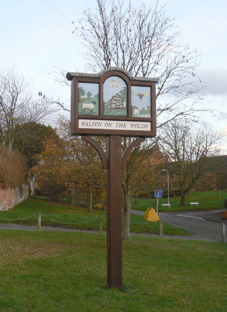
Image: © Alan Murray-Rust Taken: 25 Nov 2011
Featured are a sheep, for the traditional local agriculture, the timber framed house known as Kings Cote http://www.geograph.org.uk/photo/2712377, and a winged man. The latter is the Rev. Bertie Bird, incumbent of the parish between 1894 and 1942, who was an amateur photographer, and created trick pictures of himself flying!
Images are licensed for reuse under creativecommons.org/licenses/by-sa/2.0
Image Location
Latitude
52.772547
Longitude
-1.122895