IMAGES TAKEN NEAR TO
Derby Road, LOUGHBOROUGH, LE11 5HL
Introduction
This page details the photographs taken nearby to Derby Road, LE11 5HL by members of the Geograph project.
The Geograph project started in 2005 with the aim of publishing, organising and preserving representative images for every square kilometre of Great Britain, Ireland and the Isle of Man.

There are currently over 7.5m images from over14,400 individuals and you can help contribute to the project by visiting https://www.geograph.org.uk
Image Map
Images are licensed for reuse under creativecommons.org/licenses/by-sa/2.0
Notes
- Clicking on the map will re-center to the selected point.
- The higher the marker number, the further away the image location is from the centre of the postcode.
Image Listing (56 Images Found)
Images are licensed for reuse under creativecommons.org/licenses/by-sa/2.0
Image
Details
Distance
1
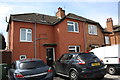
#136 Derby Road
This house is similar to those in Image but has had a brick-patterned render applied to it which has obliterated an Ordnance Survey benchmark on the side near the front corner
Image: © Roger Templeman
Taken: 30 Apr 2016
0.01 miles
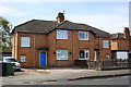
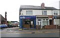
3
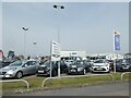
Used car dealers, Belton Road, Loughborough
Image: © David Smith
Taken: 8 Sep 2023
0.08 miles
4
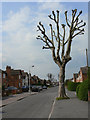
Pollarded plane tree
This type of treatment of trees is less seen these days, as it is labour intensive.
Image: © Alan Murray-Rust
Taken: 16 Apr 2011
0.11 miles
5
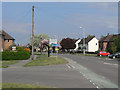
Alan Moss Road
Forming part of Loughborough's ring road, this section follows the line of the former London and North Western Railway branch from Coalville.
Image: © Alan Murray-Rust
Taken: 16 Apr 2011
0.11 miles
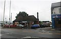
6
Magic Chicken on Derby Road, Loughborough
If I was a musician I'd expect the cheating side of town to look very much like this.
Image: © David Howard
Taken: 5 Jun 2022
0.11 miles
7
Domino's Pizza on Derby Road, Loughborough
Image: © David Howard
Taken: 5 Jun 2022
0.12 miles
8
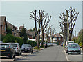
Tyler Avenue
The northern end of this street is an avenue of pollarded plane trees.
Image: © Alan Murray-Rust
Taken: 16 Apr 2011
0.12 miles
9
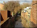
Wood Brook
Wood Brook is confined to a narrow channel as it emerges from under Derby Road
Image: © Ian Calderwood
Taken: 26 Jan 2018
0.13 miles
10
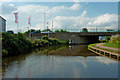
Grand Union Canal in Loughborough, Leicestershire
This is the Grand Union Canal in Loughborough, looking north-west towards Belton Road Bridge. The Loughborough Navigation (including the River Soar) was bought by the Grand Union Canal Carrying Company in 1932.
Image: © Roger Kidd
Taken: 26 Aug 2013
0.13 miles