IMAGES TAKEN NEAR TO
Pant-y-Dwr, RHAYADER, LD6 5LW
Introduction
This page details the photographs taken nearby to LD6 5LW by members of the Geograph project.
The Geograph project started in 2005 with the aim of publishing, organising and preserving representative images for every square kilometre of Great Britain, Ireland and the Isle of Man.

There are currently over 7.5m images from over14,400 individuals and you can help contribute to the project by visiting https://www.geograph.org.uk
Image Map
Images are licensed for reuse under creativecommons.org/licenses/by-sa/2.0
Notes
- Clicking on the map will re-center to the selected point.
- The higher the marker number, the further away the image location is from the centre of the postcode.
Image Listing (11 Images Found)
Images are licensed for reuse under creativecommons.org/licenses/by-sa/2.0
Image
Details
Distance
3
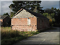
Barn at road junction in Pant-y-dwr
The building is at the north end of the small village of Pant-y-dwr and according to mapping lies extremely close to the route of an old railway.
Image: © Trevor Littlewood
Taken: 6 Oct 2010
0.15 miles
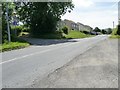
5
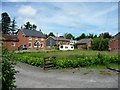
New and older houses at The Stores Farm
On the west side of the B4518, at the north end of Pant-y-dwr.
Image: © Christine Johnstone
Taken: 23 Jun 2016
0.15 miles
6
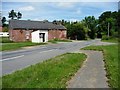
Bus shelter on the B4518, near The Store Farm
Once the site of a level crossing. Until it closed in 1962 the Mid-Wales Railway crossed obliquely here, in front of, and parallel to the barn.
Image: © Christine Johnstone
Taken: 23 Jun 2016
0.16 miles
7
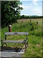
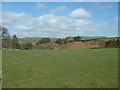
Memorial bench, east side of the B4518
Just where the railway once crossed obliquely. In the distance, a red kite flies overhead.
Image: © Christine Johnstone
Taken: 23 Jun 2016
0.16 miles
8
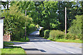
The road up the valley of Nant Tawelan
Heading west from the B4518 in a hamlet at the north end of Pant y dwr.
Image: © Christine Johnstone
Taken: 23 Jun 2016
0.17 miles
9
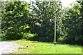
Signpost in Pant-y-dwr
It's not obvious what is signposted.
Image: © Nigel Brown
Taken: 14 Aug 2012
0.18 miles
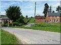
10
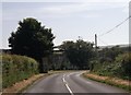
Min-y-ffordd, north end of Pant-y-dwr
Looking south along the B4518. Until it closed in 1962 the Mid-Wales Railway ran in a cutting here and the road dog-legged across it on a bridge. Since the closure, the cutting has been filled in and the road straightened as shown in this view. [The photographer had thought that there was a level crossing here, and thanks Martin Tester for his clarification].
Image: © Christine Johnstone
Taken: 23 Jun 2016
0.21 miles