
IMAGES TAKEN NEAR TO
Houston Terrace, THURSO, KW14 8PX
Introduction
This page details the photographs taken nearby to Houston Terrace, KW14 8PX by members of the Geograph project.
The Geograph project started in 2005 with the aim of publishing, organising and preserving representative images for every square kilometre of Great Britain, Ireland and the Isle of Man.

There are currently over 7.5m images from over14,400 individuals and you can help contribute to the project by visiting https://www.geograph.org.uk
Image Map
Images are licensed for reuse under creativecommons.org/licenses/by-sa/2.0
Notes
- Clicking on the map will re-center to the selected point.
- The higher the marker number, the further away the image location is from the centre of the postcode.
Image Listing (94 Images Found)
Images are licensed for reuse under creativecommons.org/licenses/by-sa/2.0
Image
Details
Distance

2
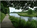
Thurso River Walk
This walk is lovely and is suitable for wheelchairs too! The walk takes you up the river across the cemetery bridge and back down to the top footbridge.
Image: © Dorcas Sinclair
Taken: 30 Jun 2003
0.09 miles
3

River Thurso from upper footbridge
Looking upstream from the footbridge linking Thurso and Millbank.
Image: © Bob Jones
Taken: 9 May 2009
0.11 miles
4

River Thurso beside The Mall Walk, Thurso
The Mall Walk provides a circular walk along the banks of the River Thurso, and this is from one bank looking towards the hidden footpath on the opposite bank.
Image: © Julian Paren
Taken: 29 Oct 2020
0.12 miles
5

The Mall Walk, Thurso
Pathways and bridges were constructed during the lifetime of the Mall Walk Project led by Thurso Rotary Club, so that there are all-weather paths out of Thurso on the banks of the River Thurso. This brings the countryside right into the centre of Thurso and its park.
Image: © Julian Paren
Taken: 29 Oct 2020
0.14 miles
6
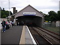
Thurso Station
The UK's most northerly railway station.
Image: © Dave Simpson
Taken: 6 Jul 2006
0.15 miles
7

The footbridge, Riverside Walk, Thurso
Image: © Bill Henderson
Taken: 28 Sep 2007
0.15 miles
8
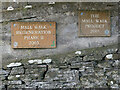
Commemorating The Mall Walk Project
Thanks to the far sightedness of Thurso Rotary Club, money was raised to rebuild walkways along the sides of the River Thurso as far as The Salmon Pool, where a new bridge was constructed over the river.
Image: © Julian Paren
Taken: 29 Oct 2020
0.15 miles
9
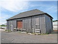
Goods Depot at Thurso Railway Station
This timber building may date from the early years of the Highland Railway. Thurso Station opened in 1874.
Image: © david glass
Taken: 23 Jun 2009
0.16 miles
10
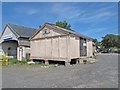
Goods Store at Thurso Railway Station
This interesting building may have been a goods depot/store. It is supported on stilts, presumably to prevent rats gaining entry.
A set of stag's antlers are mounted on the gable end.
The building was known locally as 'The Bond'.
Image: © david glass
Taken: 23 Jun 2009
0.16 miles