IMAGES TAKEN NEAR TO
Winery Lane, KINGSTON UPON THAMES, KT1 3GG
Introduction
This page details the photographs taken nearby to Winery Lane, KT1 3GG by members of the Geograph project.
The Geograph project started in 2005 with the aim of publishing, organising and preserving representative images for every square kilometre of Great Britain, Ireland and the Isle of Man.

There are currently over 7.5m images from over14,400 individuals and you can help contribute to the project by visiting https://www.geograph.org.uk
Image Map
Images are licensed for reuse under creativecommons.org/licenses/by-sa/2.0
Notes
- Clicking on the map will re-center to the selected point.
- The higher the marker number, the further away the image location is from the centre of the postcode.
Image Listing (88 Images Found)
Images are licensed for reuse under creativecommons.org/licenses/by-sa/2.0
Image
Details
Distance
1
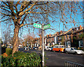
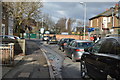
London Loop, Villiers Road, Kingston
After leaving central Kingston via paths and quiet back streets beside the Hogsmill River, the London Loop has to follow a busier roadside route for a couple of Kms where riverside access is blocked by a large sewage works and a cemetery.
This shows the Loop waymark sign pointing down Villiers Road, a street named after George Villiers, 2nd Duke of Buckingham, who was involved in the Civil War round here.
Image: © Des Blenkinsopp
Taken: 12 Dec 2011
0.04 miles
3
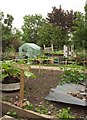
Hogsmill Gardens
Between the London Loop (and the Thames Down Link) and the Hogsmill River.
Image: © Derek Harper
Taken: 29 May 2016
0.08 miles
5

Hogsmill River in Kingston upon Thames
This photograph serves to illustrate how a combination of heavy overnight winter rain and saturated ground upstream can turn the benign watercourse seen in Hugh's Image into a dangerous raging torrent. This is about one kilometre upstream of the confluence of the Hogsmill River with the River Thames.
Image: © Nigel Cox
Taken: 19 Jan 2009
0.09 miles
8
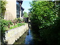
Hogsmill River seen from Mill Street bridge
The Hogsmill River is a chalk stream since most of its water comes from the dip-slope springs at Ewell. Much of its course now forms a wildlife corridor followed by the London LOOP on its way to Kingston Bridge. In the centre of Kingston near Kingston University, the corridor is narrow and the river is largely in a concrete channel but it is still attractive in places as seen here looking upriver from the footbridge at the end of Mill Street.
Image: © Marathon
Taken: 5 Jun 2013
0.11 miles
9
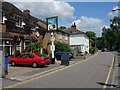
The Cocoanut
On Mill Street, Kingston.
Image: © Hugh Venables
Taken: 14 Jun 2008
0.12 miles
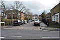
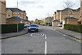
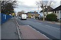
10
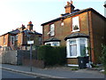
Houses on Villiers Rd
This is No. 1 and No.3 Villiers Road which are semi-detached brick built Victorian houses close to the junction with Fairfield South. There is still an open piece of land used as a recreation ground which has been known for a long time as The Fairfield.
Image: © Nigel Mykura
Taken: 21 Jul 2013
0.12 miles