
IMAGES TAKEN NEAR TO
Wherstead, IPSWICH, IP9 2AA
Introduction
This page details the photographs taken nearby to IP9 2AA by members of the Geograph project.
The Geograph project started in 2005 with the aim of publishing, organising and preserving representative images for every square kilometre of Great Britain, Ireland and the Isle of Man.

There are currently over 7.5m images from over14,400 individuals and you can help contribute to the project by visiting https://www.geograph.org.uk
Image Map
Images are licensed for reuse under creativecommons.org/licenses/by-sa/2.0
Notes
- Clicking on the map will re-center to the selected point.
- The higher the marker number, the further away the image location is from the centre of the postcode.
Image Listing (116 Images Found)
Images are licensed for reuse under creativecommons.org/licenses/by-sa/2.0
Image
Details
Distance
1
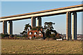
Red House
Red House, dominated by the approach piers of the Orwell Bridge. During the construction of the bridge from 1979 to 1982, Red House was used as the main site office.
Image: © Ian Capper
Taken: 11 Dec 2012
0.00 miles
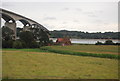
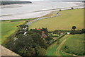
4
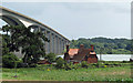
House by the bridge
The Red House, near the Orwell Bridge
Image: © Roger Jones
Taken: 17 Jul 2011
0.01 miles
5
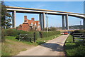
Driveway to Wherstead Hall backed by the Orwell Bridge
Traffic uses the driveway to Wherstead Hall because it has recently opened up the "Suffolk Food Hall" - an outlet for local produce with a restaurant, which seems to be proving popular. The bridge and estuary add to the interest of the location.
Image: © Andrew Hill
Taken: 11 Oct 2008
0.02 miles
6
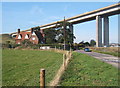
B1456 and house dominated by the western end of the Orwell Bridge
The bridge carries 57,000 vehicles daily (2007 figures). It carries combined traffic for the A14 and A12 and acts as a bypass for Ipswich. The congestion in Ipswich would be unthinkable should the bridge be closed. It is vital for access to Felixstowe town and port from almost all directions.
Image: © Andrew Hill
Taken: 11 Oct 2008
0.02 miles
7
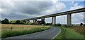
Wherstead, Suffolk
Looking in the direction of Ipswich from the vicinity of the River Orwell/A14 intersection.
Image: © Rebecca A Wills
Taken: 11 Jul 2021
0.05 miles
8
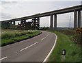
West end of the Orwell Bridge
An impressive bridge which dwarfs its surroundings.
Image: © Barbara Cook
Taken: 14 May 2006
0.06 miles
9
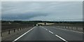
Looking down the western side of the A14 Orwell Bridge
The A14 drops to the valley and then rises to Wherstead Park Image where there is a phone mast visible. On the right are power cables which cross the river close to the bridge
Image: © David Smith
Taken: 16 Jun 2014
0.06 miles
10
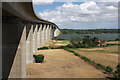
South side of the Orwell Bridge
This road bridge, opened in 1982, carries the A14 across the River Orwell with an air draught of 142 feet to allow commercial shipping to access the port of Ipswich. A lorry heading towards the Midlands from Felixstowe can just be made out on the bridge. The building to the right is known as Red House.
Image: © Bob Jones
Taken: 15 Jul 2010
0.06 miles