Red House
Introduction
The photograph on this page of Red House by Ian Capper as part of the Geograph project.
The Geograph project started in 2005 with the aim of publishing, organising and preserving representative images for every square kilometre of Great Britain, Ireland and the Isle of Man.

There are currently over 7.5m images from over 14,400 individuals and you can help contribute to the project by visiting https://www.geograph.org.uk
Red House
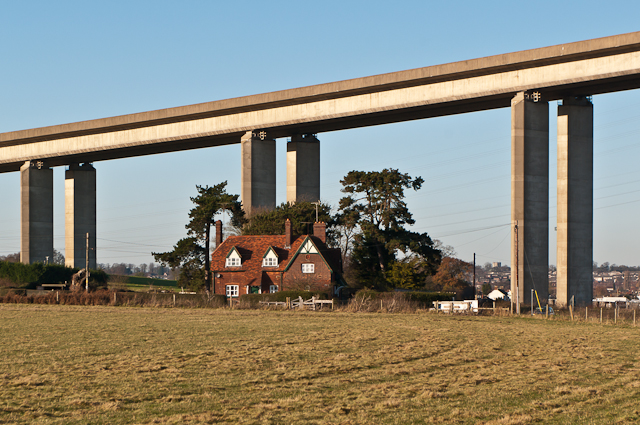
Image: © Ian Capper Taken: 11 Dec 2012
Red House, dominated by the approach piers of the Orwell Bridge. During the construction of the bridge from 1979 to 1982, Red House was used as the main site office.
Images are licensed for reuse under creativecommons.org/licenses/by-sa/2.0
Image Location
Latitude
52.025931
Longitude
1.159126