
IMAGES TAKEN NEAR TO
Airfield Road, BURY ST. EDMUNDS, IP32 7RH
Introduction
This page details the photographs taken nearby to Airfield Road, IP32 7RH by members of the Geograph project.
The Geograph project started in 2005 with the aim of publishing, organising and preserving representative images for every square kilometre of Great Britain, Ireland and the Isle of Man.

There are currently over 7.5m images from over14,400 individuals and you can help contribute to the project by visiting https://www.geograph.org.uk
Image Map
Images are licensed for reuse under creativecommons.org/licenses/by-sa/2.0
Notes
- Clicking on the map will re-center to the selected point.
- The higher the marker number, the further away the image location is from the centre of the postcode.
Image Listing (30 Images Found)
Images are licensed for reuse under creativecommons.org/licenses/by-sa/2.0
Image
Details
Distance
1
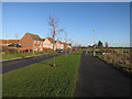
Airfield Road, Moreton Hall
Moreton Hall is a major, ongoing, expansion of Bury St. Edmunds.
Image: © Hugh Venables
Taken: 22 Dec 2016
0.06 miles
2
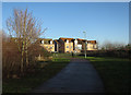
Moreton Hall
A major, ongoing, expansion of Bury St. Edmunds.
Image: © Hugh Venables
Taken: 22 Dec 2016
0.08 miles
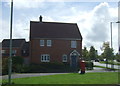
4
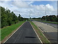
National Cycle Route 13
Heading east beside Mount Road, Bury St Edmunds.
Image: © JThomas
Taken: 14 Sep 2015
0.12 miles
5
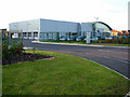
Audi dealership new premises
On the edge of the Moreton Hall estate, looking out across Rougham Airfield to the east
Image: © John Goldsmith
Taken: 8 Oct 2008
0.16 miles
7

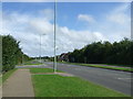
Moreton Hall estate from Rougham Airfield
The Moreton Hall estate and (inevitably in 'Sugartown') the sugar factory are silhouetted in the sunset. Photographed from Rougham Airfield, a Second World War airfield used mainly by B17s, and now used as an airfield and special events venue. You can see the mowed secondary runway. In the trees is the Flying Fortress public house.
Image: © John Goldsmith
Taken: 16 Aug 2005
0.17 miles
8
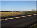
Lady Miriam Way
Part of Moreton Hall, a major and ongoing expansion of Bury St. Edmunds.
Image: © Hugh Venables
Taken: 22 Dec 2016
0.17 miles
9
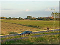
New road, between Moreton Hall estate and Rougham Airfield
This road is too new to appear on the Landranger maps on Geograph. The Moreton Hall estate is behind, Rougham Airfield in front. The industrial estate that grew from the wartime buildings can be seen in the distance in the next square.
Those trees on the right feature in thousands of photos every year, thanks to the regular model and full size aircraft shows.
This scene was photographed from the same earth pile as Image
I'm hoping that cyclist has noticed my parked MG ZS180.
Image: © John Goldsmith
Taken: 6 Oct 2008
0.17 miles
10
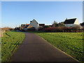
Moreton Hall
A major, ongoing, expansion of Bury St. Edmunds.
Image: © Hugh Venables
Taken: 22 Dec 2016
0.17 miles