Moreton Hall estate from Rougham Airfield
Introduction
The photograph on this page of Moreton Hall estate from Rougham Airfield by John Goldsmith as part of the Geograph project.
The Geograph project started in 2005 with the aim of publishing, organising and preserving representative images for every square kilometre of Great Britain, Ireland and the Isle of Man.

There are currently over 7.5m images from over 14,400 individuals and you can help contribute to the project by visiting https://www.geograph.org.uk
Moreton Hall estate from Rougham Airfield
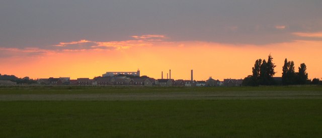
Image: © John Goldsmith Taken: 16 Aug 2005
The Moreton Hall estate and (inevitably in 'Sugartown') the sugar factory are silhouetted in the sunset. Photographed from Rougham Airfield, a Second World War airfield used mainly by B17s, and now used as an airfield and special events venue. You can see the mowed secondary runway. In the trees is the Flying Fortress public house.
Images are licensed for reuse under creativecommons.org/licenses/by-sa/2.0
Image Location
Latitude
52.246788
Longitude
0.750387