
IMAGES TAKEN NEAR TO
Bradfield Hall, BURY ST. EDMUNDS, IP30 0LU
Introduction
This page details the photographs taken nearby to Bradfield Hall, IP30 0LU by members of the Geograph project.
The Geograph project started in 2005 with the aim of publishing, organising and preserving representative images for every square kilometre of Great Britain, Ireland and the Isle of Man.

There are currently over 7.5m images from over14,400 individuals and you can help contribute to the project by visiting https://www.geograph.org.uk
Image Map
Images are licensed for reuse under creativecommons.org/licenses/by-sa/2.0
Notes
- Clicking on the map will re-center to the selected point.
- The higher the marker number, the further away the image location is from the centre of the postcode.
Image Listing (12 Images Found)
Images are licensed for reuse under creativecommons.org/licenses/by-sa/2.0
Image
Details
Distance
1
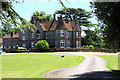
Bradfield Hall
This historic house in the village of Bradfield Combust has been converted into 17 flats and apartments.
Image: © Bob Jones
Taken: 23 Jun 2009
0.04 miles
2
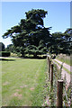
Grounds of Bradfield Hall
The track to the right is also a public footpath, leading to Bradfield St Clare. The fence marks the boundary of the grounds of Bradfield Hall. The grounds are well-known for many unusual species of tree, one of which can be seen ahead.
Image: © Bob Jones
Taken: 23 Jun 2009
0.09 miles
3
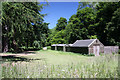
Scout campsite, Bradfield Combust
Bradfield Park campsite is used by scouts and other youth organisations. http://www.bradfieldparkcampsite.org.uk/camping.html
Image: © Bob Jones
Taken: 23 Jun 2009
0.11 miles
4
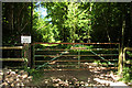
Gateway to Gorse Covert
The track near Bradfield Hall leads into privately-owned woodland, known as Gorse Covert. The sign warns errant walkers, passing the gate on a public footpath.
Image: © Bob Jones
Taken: 23 Jun 2009
0.15 miles
5
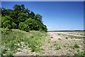
Gorse Covert, Bradfield Combust
The patch of woodland lies north of Bradfield Hall. The field to the east of the covert is currently lying fallow.
Image: © Bob Jones
Taken: 23 Jun 2009
0.16 miles
6
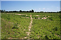
Footpath to Bradfield St Clare
The path, which links the two Bradfields - Combust and St Clare - diagonally crosses a fallow field.
Image: © Bob Jones
Taken: 23 Jun 2009
0.22 miles
7
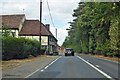
A134 looking north, Bradfield Combust
A route from Colchester to King's Lynn, next major place, Bury St Edmunds. Parts of its route are on a Roman alignment, as here, although the A134 pulls off the Roman line just ahead.
Image: © Robin Webster
Taken: 21 Aug 2022
0.24 miles
8
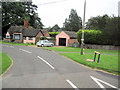
Lodge Cottage in Bradfield Combust
Located in Ixer Lane just off the A134
Image: © John Firth
Taken: 13 Sep 2010
0.24 miles
10
Ixer Lane, Bradfield Combust
Near the junction with the A134 The Street
Image: © Geographer
Taken: 3 Oct 2014
0.25 miles