
IMAGES TAKEN NEAR TO
Bourne Terrace, IPSWICH, IP2 8NG
Introduction
This page details the photographs taken nearby to Bourne Terrace, IP2 8NG by members of the Geograph project.
The Geograph project started in 2005 with the aim of publishing, organising and preserving representative images for every square kilometre of Great Britain, Ireland and the Isle of Man.

There are currently over 7.5m images from over14,400 individuals and you can help contribute to the project by visiting https://www.geograph.org.uk
Image Map
Images are licensed for reuse under creativecommons.org/licenses/by-sa/2.0
Notes
- Clicking on the map will re-center to the selected point.
- The higher the marker number, the further away the image location is from the centre of the postcode.
Image Listing (15 Images Found)
Images are licensed for reuse under creativecommons.org/licenses/by-sa/2.0
Image
Details
Distance
1
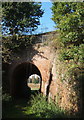
Railway bridge taking footpath under the line to Ipswich
A substantial bridge due to the height of the railway embankment at this point.
Although close to the A137 the track and bridge are onscured by trees.
Image: © Andrew Hill
Taken: 11 Oct 2008
0.10 miles
3

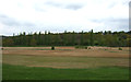
Meadow backed by railway embankment
The line south from Ipswich towards Colchester and London.
Image: © Andrew Hill
Taken: 11 Oct 2008
0.16 miles
4
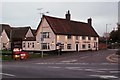
'Oyster Reach' inn
This is the original 16th century inn that has now been extended to become a Beefeater restaurant. The road that runs parallel with the front of the inn, is Bourne Hill and that was once the original A.137
Image: © Robert Edwards
Taken: 20 Nov 2006
0.17 miles
5
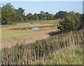
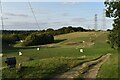
Low lying field by the A137
The trees allow barely a glimpse of the nearby southern outskirts of Ipswich. The low lying fields by Belstead Brook define the southern edge of the town.
Image: © Andrew Hill
Taken: 11 Oct 2008
0.18 miles
7
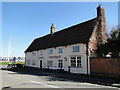
The 'Oyster Reach' public house
http://www.geograph.org.uk/photo/5318733
Image: © Adrian S Pye
Taken: 21 Mar 2017
0.22 miles
8
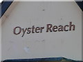
The gable end of the 'Oyster Reach' public house
http://www.geograph.org.uk/photo/5318729
Image: © Adrian S Pye
Taken: 21 Mar 2017
0.22 miles
9
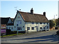
Beefeater restaurant, near Bourne Bridge, Ipswich
A former pub, that seems to have been divested of any specific name or reference to alcohol, and now is indicated to be just a restaurant. Behind is an associated Premier Inn. The old pub part is a grade II listed building, 16th/17th centuries with many later additions and alterations. It was originally The Ostrich, which name lives on in that of the nearby creek.
Image: © Robin Webster
Taken: 19 Nov 2017
0.23 miles
10
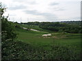
Suffolk Ski Centre
On a Sunday afternoon in May there were still quite a few people skiing and snowboarding.
Image: © Barbara Cook
Taken: 14 May 2006
0.23 miles