'Oyster Reach' inn
Introduction
The photograph on this page of 'Oyster Reach' inn by Robert Edwards as part of the Geograph project.
The Geograph project started in 2005 with the aim of publishing, organising and preserving representative images for every square kilometre of Great Britain, Ireland and the Isle of Man.

There are currently over 7.5m images from over 14,400 individuals and you can help contribute to the project by visiting https://www.geograph.org.uk
'Oyster Reach' inn
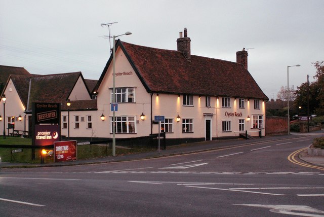
Image: © Robert Edwards Taken: 20 Nov 2006
This is the original 16th century inn that has now been extended to become a Beefeater restaurant. The road that runs parallel with the front of the inn, is Bourne Hill and that was once the original A.137
Images are licensed for reuse under creativecommons.org/licenses/by-sa/2.0
Image Location
Latitude
52.032481
Longitude
1.148987