
IMAGES TAKEN NEAR TO
Mulberry Close, THETFORD, IP26 4AZ
Introduction
This page details the photographs taken nearby to Mulberry Close, IP26 4AZ by members of the Geograph project.
The Geograph project started in 2005 with the aim of publishing, organising and preserving representative images for every square kilometre of Great Britain, Ireland and the Isle of Man.

There are currently over 7.5m images from over14,400 individuals and you can help contribute to the project by visiting https://www.geograph.org.uk
Image Map
Images are licensed for reuse under creativecommons.org/licenses/by-sa/2.0
Notes
- Clicking on the map will re-center to the selected point.
- The higher the marker number, the further away the image location is from the centre of the postcode.
Image Listing (174 Images Found)
Images are licensed for reuse under creativecommons.org/licenses/by-sa/2.0
Image
Details
Distance
1
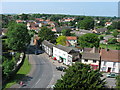
Looking South West from St Mary's Tower
The junction of High Street and St Mary's Street with grocery store (Manchester House, the white one, centre photo) and newsagents (just behind foreground tree) visible. High Street is one-way as it can't take 2 lorries and parked cars! This is looking over old Feltwell. John Brewington, a survivor of the Charge of the Light Brigade lived in the grey, flint house next to Manchester House. For more picture of Feltwell visit http://www.feltwell.org
Image: © Paul Garland
Taken: 9 Jun 2007
0.05 miles
3
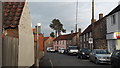
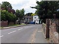
High Street, Feltwell
Looking east. The One Stop shop just edging into the view on the right is one of two convenience stores in Feltwell.
Image: © Chris Brown
Taken: 5 Nov 2017
0.06 miles
4
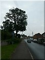
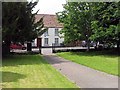
Looking south-west along the High Street
Image: © Basher Eyre
Taken: 26 Sep 2021
0.07 miles
6
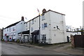
The Wellington public house and restaurant
Named after the Vickers Wellington which flew from RAF Feltwell during WW2.
There are murals on the wall of the Beer Garden as well as a good few mementos and photographs inside.
https://www.geograph.org.uk/photo/6399687
Image: © Adrian S Pye
Taken: 26 Feb 2020
0.07 miles
7
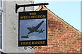
Sign of The Wellington public house, Feltwell
https://www.geograph.org.uk/photo/6399685
Image: © Adrian S Pye
Taken: 26 Feb 2020
0.07 miles
9
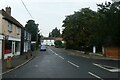
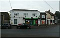
Looking from Bell Street into St Mary's Street
Image: © Basher Eyre
Taken: 26 Sep 2021
0.07 miles
10
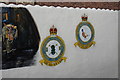
Wellington Wall, 75 squadron and RAF Feltwell station badge as a mural
The mural is a pictorial memorial to the men of 75 New Zealand squadron who served at RAF Feltwell in WW2. https://www.feltwellington.co.uk/wellington-wall
https://www.geograph.org.uk/photo/6399685
Image: © Adrian S Pye
Taken: 26 Feb 2020
0.08 miles