Looking South West from St Mary's Tower
Introduction
The photograph on this page of Looking South West from St Mary's Tower by Paul Garland as part of the Geograph project.
The Geograph project started in 2005 with the aim of publishing, organising and preserving representative images for every square kilometre of Great Britain, Ireland and the Isle of Man.

There are currently over 7.5m images from over 14,400 individuals and you can help contribute to the project by visiting https://www.geograph.org.uk
Looking South West from St Mary's Tower
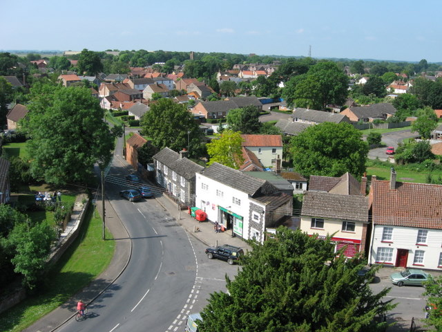
Image: © Paul Garland Taken: 9 Jun 2007
The junction of High Street and St Mary's Street with grocery store (Manchester House, the white one, centre photo) and newsagents (just behind foreground tree) visible. High Street is one-way as it can't take 2 lorries and parked cars! This is looking over old Feltwell. John Brewington, a survivor of the Charge of the Light Brigade lived in the grey, flint house next to Manchester House. For more picture of Feltwell visit http://www.feltwell.org
Images are licensed for reuse under creativecommons.org/licenses/by-sa/2.0
Image Location


Leaflet Map data © OpenStreetMap
Latitude
52.486482
Longitude
0.522863