1
Brome Industrial Estate
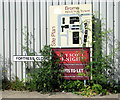
Fortress Close road sign - some of the roads on the industrial estate were given names associated to RAF Eye, which was an active airfield during WW2.
Image: © Evelyn Simak
Taken: 3 Jun 2015
0.03 miles
2
View along Liberator Way
The road (and public footpath) skirts the northern periphery of the Brome Industrial Estate. It is named after the Liberator bomber aircraft flown from RAF Eye, which was an active airfield during WW2. Part of a spectacle aircraft dispersal can be seen at right, on the other side of the fence.
Image: © Evelyn Simak
Taken: 3 Jun 2015
0.04 miles
3
Dark clouds over the Brome Industrial Estate
View looking along Liberator Way, which skirts the northern periphery of the industrial estate. To the right is one of only a few aircraft dispersals dating from the time when RAF Eye was an active airfield during WW2.
Image: © Evelyn Simak
Taken: 3 Jun 2015
0.05 miles
4
Romney hut on the Council Depot in Liberator Way
One of the few original buildings which have survived on the former Technical site of RAF Eye, which was an active airfield in WW2. The Council Depot occupies part of a spectacle dispersal and this particular hut would seem to have been moved to its current location from across the road from here. Romney huts are prefabricated steel structures. They were developed during WW2 and constructed of a clamped clamped tubular steel frame with a central entrance. The hut was used to accommodate facilities for which abnormal roof spans were required and on some airfields two or more would be erected to house large stores and workshops.
Image: © Evelyn Simak
Taken: 3 Jun 2015
0.05 miles
5
Romney hut on the Council Depot in Liberator Way
One of the few original buildings which have survived on the former Technical site of RAF Eye, which was an active airfield in WW2. The Council Depot occupies part of a spectacle dispersal and this particular hut would seem to have been moved to its current location from across the road from here. Romney huts are prefabricated steel structures. They were developed during WW2 and constructed of a clamped clamped tubular steel frame with a central entrance. The hut was used to accommodate facilities for which abnormal roof spans were required and on some airfields two or more would be erected to house large stores and workshops.
Image: © Evelyn Simak
Taken: 3 Jun 2015
0.05 miles
6
Brome Industrial Estate
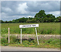
Liberator Way road sign - some of the roads on the industrial estate were given names associated to RAF Eye, which was an active airfield during WW2.
Image: © Evelyn Simak
Taken: 3 Jun 2015
0.06 miles
7
Spectacle dispersal beside Liberator Way
This is where aircraft were parked when not on active duty. Today the dispersal is used for storing what would appear to be lime fertiliser.
Image: © Evelyn Simak
Taken: 3 Jun 2015
0.06 miles
8
Approaching the B1077 road on Nick's Lane
Now a public bridleway, the concreted track dates from the time when RAF Eye was an active airfield during WW2 and used to link the various domestic and communal sites with each other and with the aerodrome's Technical and Administrative sites.
Image: © Evelyn Simak
Taken: 3 Jun 2015
0.12 miles
9
Business property on the Brome Industrial Estate
Image: © Evelyn Simak
Taken: 3 Jun 2015
0.14 miles
10
Brome Industrial Estate
The storage sheds of the Bartrum Group Ltd.
Image: © Evelyn Simak
Taken: 3 Jun 2015
0.16 miles


